In the Black Lion in Lampeter I have an early breakfast and take the T1 bus back to Llanybydder. Rain has arrived overnight, thin rain that’s no bother now but might be if it continues for hours. The clouds are low, and visibility poor. On the bus and round the village are figures in high-vis jackets, workers from overseas on their way to work in the Dunbia slaughterhouse or ‘meat processing plant’ on the north edge of Llanybydder. About 650 people work here, about half of them from Poland and other countries. Dunbia, no doubt, is the final destination of most of the lambs I’ve seen feeding in the fields on my travels.

As a community Llanybydder has probably changed more than most villages in the Teifi valley – certainly since the pre-WW2 days recalled by Ray Evans in her classic autobiographical work, Y llyffant. Housing has expanded in all directions from the centre, and it takes at least quarter of an hour to reach the open country, along the Rhydcymerau road, with its views of Pen-y-gaer hillfort, and then up the lane south towards Llidiad Nennog. By this time, resigned to the continuous rain, I’m wearing full waterproofs.

At Gilfach-wen the Trail turns right, and then, opposite a house, takes an abrupt and nearly invisible right turn across a pony field. I’d been warned by a woman who stopped her car to tell me that it was almost inevitable I’d miss this turning – and I did. In the field the ponies prance over to say hello: they probably see few visitors up here. The path leads to a gate into a birch wood, dark and damp this morning, but well-equipped with boardwalks in its boggy parts. More fields, and more climbing. The guidebook assures me that from here, near Emmardeg, there are ‘good views of the Teifi valley and of Pen-y-gaer hillfort’. But not this morning. All I can see is an unending grey screen of cloud.

All the climbing I’ve done so far is now reversed. A tarmac lane falls steeply, until, past Waun-gron, it gives up and turns into a track. Climbing once again, and this time seriously and lengthily, the track takes me towards Blaenplwyf. Soon after, the Trail offers an alternative, lower and shorter, route, but I’m now so wet that there’s nothing to be gained by yielding to temptation, and I choose the upland path. Next there are two valleys and streams to cross, Nant Geredig and Nant Ceiliog – more descending and climbing. The drop to Nant Ceiliog takes a zig-zag course to accommodate the carts that once travelled this way, and at the bottom is a tricky boggy stretch. The path out of the valley passes Cae’r Neuadd, a bohemian-looking house that might have been the home of an artist.

Next comes what, on a brighter day, would be the highlight of today’s walk. The Trail follows a track that skirts the edge of a large area of high moorland, Mynydd Llanllwni, bleak and remote common land, in warmer times the haunt of Bronze Age people and now designated as a Dark Sky Discovery site. To my left is a sea of bracken, which gives way at a higher contour to low grasses and heather. And to my left are, or so I read, ‘wonderful views’ to the Teifi valley. To my surprise, a few dog walkers are plodding along the track in the rain, as well as some depressed-looking sheep. By now the wind from the south-west has risen, the rain is more penetrating, and the sky shows a dusk-like darkness.

At Mountain Gate, also known as Pennsylvania, the Trail joins the road across Mynydd Llanllwni (yet another way of getting to Llidiad Nennog) and turns west. This road, according to the guidebook, was called Heol Lloegr, because it follows an old droving route to England. After a mile or so, the Trail leaves the road and falls along a beautiful green lane with high banked hedges on either side (surely also a droving route?), to the main Carmarthen to Lampeter road at Llanllwni. Llanllwni is one of the most elongated villages in Wales; it seems to continue for miles with odd houses and clumps of houses strung along the course of the road.

But the Trail ignores all this. It crosses the main road and takes a tour of the back parts of the village before using fields and then a series of lanes to make for its historic centre, Maesycrugiau. At one point one of the lanes crosses the line of the old railway, a sad sight. Finally, a path across fields leads to the banks of the Teifi.

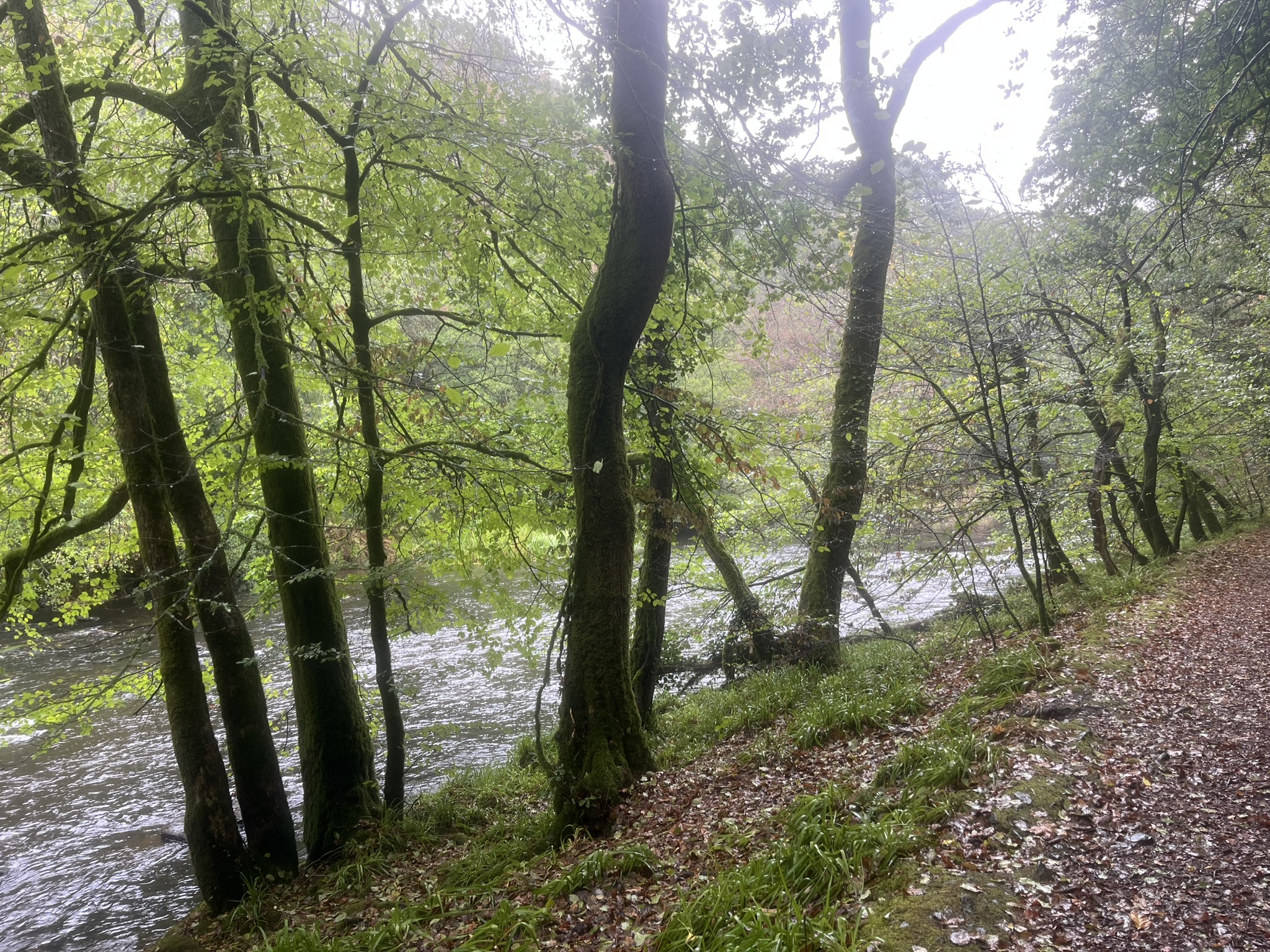
Even the weather can’t spoil the next section, a riverside walk through a narrow gorge lined by bare rockfaces and overhanging trees. I take the recommended diversion to visit St Luke’s Church, which sits high above the river, with a large undulating graveyard on the river side. Today’s is a long walk, over thirteen miles, and since I’ve reached or maybe passed the half-way point, it’s time to eat some wet sandwiches, while sheltering as best I can under the arch of the entrance under the church’s tall tower.

Below, the path resumes along the river until it reaches Pont Llwni, where there’s a pretty collection of houses overlooking the flood plain. After some more road walking the Trail climbs steeply through a wood and then enters a long bridle path going downhill. After the rains this is tricky underfoot, with leaves covering hidden, slippery stones. Afon Clettwr sits in a deep valley, and after the bridge there’s a very steep, overgrown path uphill out of it. After that, roads take over. After Pen-rhiw farm there’s a long, steep descent, hard on the knees, down to a path by the Teifi. The path then forms a semicircle as it moves from field to field, shadowing the river on its meandering course to Llandysul.

The rain has ceased for the time being, and it feels warmer. I’m starting to tire now, so I take a break, sitting on a stile and taking in the pastoral landscape around me, a bowl of wooded hills surrounding the river and its plain. Further on, I pass the small island, ‘a secret haven, a small wilderness’, visited twice by Jack Smylie Wild in his quiet meditation on the Teifi, Riverwise. In the final stretch of the walk I do a spot of trespassing, and instead of joining the road to pass Abercerdin Mill, I carry on along the river, ford Afon Cerdin and visit the pedestrian bridge, only crossable by local anglers.

Llandysul is mainly asleep when I get there. Time and the bypass have done no favours to the town, and the number of shops has shrunk. Bus services are sparse. The church is closed (I’ve never found it open on any visit). But the Porth Hotel is open, and I treat myself to a beer while I wait for the taxi to take me on the short journey to Pencader to catch the T1 bus.

I’ve another wait in Pencader, usually another ‘village for passing through’. I use the time to explore. There’s Yr Hen Gapel, a handsome building of 1827 with four arched windows; traces of the old railway where it crossed Nant Gwen; Capel Tabernacl, iced-up and ready to eat; the old Blossom Garage belonging to the much-missed bus company Davies Bros.; and an unusual roadside plaque put up by Plaid Cymru in 1952. This gives the text of the rousing prophecy of the ‘Old Man of Pencader’ about the survival of Wales and the Welsh language that Giraldus Cambrensis quotes (or makes up) at the conclusion of his Description of Wales:
Geiriau hen Gymro wrth Harri II frenin Lloegr ym Mhencader yn 1163. Gellir gorthrymu’r genedl hon yn wir, ac i raddau helaeth iawn ei dinistrywio a’i llesgau trwy dy nerthoedd di O frenin, ac eiddo eraill, yn awr megis cynt a llawer gwaith eto pan haedda hynny. Ei dileu’n llwyr, fodd bynnag, trwy ddigofaint dyn, ni ellir, oni bydd hefyd ddigofaint Duw yn cydredeg ag ef. Ac nid unrhyw genedl arall, fel y barnaf i, amgen na hon o’r Cymry, nac unrhyw iaith arall, ar Ddydd y Farn dostlem gerbron y Barnwr Goruchaf pa beth bynnag a ddigwydd i’r gweddill mwyaf ohoni a fydd yn ateb dros y gongl fach hon o’r ddaear.

And so back to Carmarthen and Swansea. Stage 3 of the Trail, from Llandysul to Poppit Sands, must wait for another time – and, with luck, better weather.


Leave a Reply