The Wales Coast Path day by day.
 Turquoise sea, north Pembrokeshire
‘Rare souls’ is how the authorities describe people who choose to walk the whole 870 miles of the Wales Coast Path. We didn’t feel either rare or soulful, Chris and I, when we set out from Poppit Sands on 4 May 2013. But we did feel certain that the walk would be one to remember. And we were determined to record the experience, in words and pictures, day by day.
Why walk?
People walk the unabridged Path for many reasons. Some want to raise money for charity. Others are looking for a ‘challenge’. Others again feel a deep inner impulse – to beat a record, or escape from the ordinary world, or to celebrate recovery from an illness. But we started out with no such noble aim. We walked the Path because, as George Mallory said of Everest, ‘it was there’. The Welsh Government had designated it just a year earlier, making Wales the first country to have a complete coastal footpath.
And we walked it because we wanted to learn more about the country we lived in.
And because we thought it would be fun.
Why so slow?
 The two walkers
It’s taken us five and a half years. Some people complete the Path in a few weeks, with few, or even no, breaks. They think nothing of covering fifteen to twenty miles a day – or more, if they’re running rather than walking. That wasn’t our style. Slow Walking was our preference. Our daily maximum was sixteen miles, and sometimes we managed no more than five or six. Slow Walking has many advantages. It gives more time to stand and stare, take photos, chat to ourselves and people we meet, rest and eat, take diversions, and learn more about where we are, and who was here before us. We feel no need to apologise.
How complete is ‘complete’?
 Barmouth Bridge
The Coast Path has an official route, laid down by its curators in Natural Resources Wales. But it isn’t a fixed line. The Path changes all the time, as sea erosion forces it inland, or new agreements are reached with landowners, or for other reasons. Sometimes it’s not always easy to find on the ground. But we worked on the assumption that we’d try to walk the entire route. From the start I was a more literal completist than Chris – he was readier to take short cuts – but as time went on my fundamentalism softened. If pressed, we would confess to having missed a few, very minor sections.
The Path itself is ‘incomplete’, of course. It has to deviate inland on many occasions: to avoid military bases, as at Castlemartin or Aberporth, or because of recalcitrant private landowners, as at Gwbert and Cardigan Island, and the National Trust (Plas Newydd).
The walk captured
 Camera man
Both of us walked with cameras. We tended to stop at the same point, take two copies of the same scene, and later upload each of them to our respective Flickr sites. So there you can see two, almost but not quite identical, albums of our travels.
In addition, after each day’s walking I’d write a brief account of the day – the route and the landscape, our encounters and adventures, the events and characters associated with the walk. Then I’d published it as a blog post, with a few pictures. The entries vary in length – some evenings I was too tired to write much – and in tone: by turns observational, lyrical, historical, anecdotal and scurrilous. Now all the blogs are stitched together in a single linear sequence, from Chepstow to Chester.
The Wales Coast Path day by day
Designing the walk
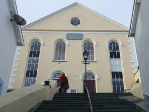 Tabernacl, Aberdyfi
There was nothing very systematic about how we planned our walking. Months would go by, especially in winter and the rainy season, when we’d do nothing. In south Wales we walked a day at a time, since everywhere was within easy reach of home. Once beyond Carmarthenshire we tended to rent a cottage or flat for a week – having our own base for relaxing and exploring was a blessing – and we’d fit in six or seven days of continuous walking. All the places we stayed in were excellent, at least once we’d overcome minor irritants – by blocking a noisy toilet cistern with a cheese grater, or silencing Billy Bass the Singing Fish. Our preferred times were late spring and early summer, and early autumn. We tried to avoid school holidays and bad weather.
We started in north Pembrokeshire, but then moved on to bits of the south Wales coast, and usually had several fronts open at once. We didn’t mind which direction we walked in, clockwise or anticlockwise. And we left one special gap till the end, on 9 September 2018: from the centre of Swansea to our homes in Mumbles.
Guestwalkers
 Porthmadog guestwalkers
We’re comfortable in each other’s company, Chris and I, but it was good to have partners and friends join us from time to time. We called them ‘guestwalkers’. In the blog text they’re given initials. Sometimes they’d come for several days and stay overnight with us, often they’d come for the day. They gifted to us their special skills and expertise – in bird life, car technology, eighteenth century history, canine behaviour, first aid and much else – and our conversations were always enriched by their presence. We’d talk about many things – films and football, puffins and politics, grandchildren and lost friends. In reflective mood we’d tackle more difficult questions, like whether dogs can foretell their own deaths, how to solve the Mind in a Vat problem, and the existence of parallel universes. But often we’d move ahead in silence, and sometimes fall into a kind of repetitive walking trance.
Felly, diolch yn fawr iawn i: Andrew, Anne, Carys, Clive, Dafydd, Hilary, Jack the dog (deceased), Jenny, Jeremy, Josh, Lydia, Martin, Mike (x2), Mary-Ann, Peter and Stuart.
How to get there
 Morfa Mawddach
Early on we became experts at logistics – especially how to get to the start of a walk, and back at its end. Usually we had two cars available, and if it was unavoidable we played the ‘two car trick’, leaving one car at the destination and the other at the starting point. But this always meant two car journeys at the beginning and end of each walk. We preferred if we could to use public transport; when we stayed for a week it helped to choose a public transport hub, like Pwllhelli in Llŷn. We pored long over timetables, and searched out special coast bus services, like the Cardi Bach and the Puffin Shuttle. Bus and train journeys were usually a joy, and a good way of meeting people. Buses were free to ride (to Welsh over-60s), and sometimes trains too: we’d do the modern equivalent of ‘ridin’ the blinds’ when train managers working for the wretched Arriva Trains Wales felt too alienated to collect our short-haul fares. Remoteness (the Cambrian Coast line) and extreme localness (small north Wales bus companies) made for eccentric and unexpected travelling experiences.
Finding the way, and losing it
 Getting lost
We had four ways of trying to find the route. The Wales Coast Path website has downloadable and printable maps. Ordnance Survey Explorer maps (1:25,000) show the line of the Path, at least as it was at the time of printing. Guidebooks – all sections now have at least one – offer basic route-finding instructions, as well as sections of maps (usually on an inadequate 1:50,000 scale). And finally, attached to posts, walls or more obscure features, are the circular Coast Path waymarkers, each with its white dragon-tailed conch on a blue background and yellow surround. (Anglesey and Ceredigion keep their original, pre-Coast Path branding, on the principle of ‘we were here first’.)
None of these, even when used all together, saved us from getting lost. We walked round one notorious large field near Cardigan twice, the cows within staring at us incredulously, before realising we shouldn’t have been there at all. After a ‘short cut’ across Kenfig dunes we were driven to near madness, and wondered whether only our bleached bones would survive. On hills above Nant Gwrtheryn we got lost in mist and were only rescued by a couple of mysterious young women. The truth is that maps are never quite detailed enough, guidebooks are too vague, and signposts don’t always exist (as on the stretch between Caernarfon and Bangor). And there’s no accounting for the sheer stupidity of walkers.
Going off-Path
 Dulas Bay
Apart from getting lost, we deviated from the course of the Path for two reasons: out of necessity, and to pursue diversions.
Sometimes the Path was inaccessible. The commonest reason was high tide in a creek (or ‘pill’) or estuary. The easiest way of avoiding what might turn out to be a long diversion is to study tide times in advance and plan accordingly. Flooding is another hazard. At the head of Dulas Bay in Anglesey we found a pedestrian bridge which led straight into a deep pool of water. On the island’s south coast an exceptionally high tide drowned the shore-side path and we had to trespass, thrillingly, through dense undergrowth, to safety. In Nefyn, on the other hand, a sign said the Path was closed, but we ignored it and ploughed on. Industry also bends the Path away from the coast: Tata Steel diverted us at Port Talbot, Wylfa Power Station near Cemaes, and at Barry we were away from the sea for a long stretch. The military cause more problems (see below).
All this means that the Path is sometimes inland and hilly, or even mountainous, rather than always being low-level and coastal – as on the Dyfi estuary, or on Yr Eifl, or between Fairbourne and Llwyngwril.
Elective diversions happened for all kinds of reason: to search for food or shelter, to visit a neolithic burial chamber, or once to search out the Prestatyn street where I stayed with my great aunts in the early 1960s.
Stoking the engines
 Porth Dinllaen
A simple fact: walking makes you thirsty, then hungry. You learn quickly that food and drink en route need forethought. Water bottles are heavy to carry, but worse is to find yourself thirsty and waterless in a remote, dry place. Some stretches, like St Dogmaels to Newport and the Wentloog and Gwent Levels, are long and barren of shops and cafés, making sandwiches essential (mine, oversize and uncut, attracted ridicule). But a perfectly planned day would start with coffee and cake (ideally, at the yacht club in Dale), break half way for a bite and a drink in a seaside pub (like the Tŷ Coch at Porth Dinllaen), and finish with ice creams all round (say, at Cadwalladers in Cricieth). On one hot Pembrokeshire cliff walk we started to suffer delusions, believing that we could see an ice cream van on the beach at Abereiddy a couple of miles ahead (luckily it wasn’t a mirage, but real). We were partial to fish and chips, too, and our friend J. kept an official Index (scale 1-10) of their quality.
Nature walks
 Pembrokeshire seals
For urbanites the Coast Path is a crash course in the natural world. Neither of us is a naturalist or geographer, but we couldn’t help learning quickly about the land we were walking through, and its animal and insect inhabitants. A living guide was best. M., our ornithologist guest, could identify kestrels and choughs for us in a second. Left to ourselves we had the guidebooks, but mostly they were too vague to help much with identification. The exception was Brian John’s Pembrokeshire guide (‘Dr John’). He’s a geologist and his vivid descriptions of the contorted rocks of that county are superb.
Stonechats, wheatears, curlews, skylarks, redshanks, oystercatchers: we learned to recognize these birds and more. If we didn’t hear a skylark at least once a day we felt cheated (though a century ago we could have expected dozens a day). Sheep, cows, horses and dogs were everywhere. Sometimes they would behave in unexpected ways, but it was only dogs that gave us trouble. It helped when the dog-owning J. was with us: we could rely on him to calm even Cerberus. Speaking of dogs, dog shit was sometimes a problem: we approved of one sign that announced ‘Dog fouling – pick it up (or if you’re too lazy, train your dog to do it’). We’ll not forget easily hearing the mournful, ghostly calls of seals on rocks below us, drifting on the wind in north Llŷn. But maybe the most astonishing natural sight was the unending display of late spring flowers carpeting the clifftops and pathsides of western Anglesey.
Some constants
 Falling man
Some things you expect to see regularly on the Coastal Path. The first, naturally enough, is the sea. It constantly changes mood, sound and colour, even in a single day. In north Pembrokeshire its colour in sunshine is a deep turquoise, matched nowhere else. We were always surprised at how empty the seaways were, with very few passing boats (despite the crowded marinas).
Then there’s sand, a word that conceals a huge variety of types – firm as tarmac, apparently firm but collapsing, and impossibly soft and energy-sapping. Fine judgement was needed to decide whether beachwalking was a wiser choice than sticking to the inland path. Sand also tends to be very exposed: we were lashed by vicious rain, to within an inch of our lives, out on the long beach at Harlech.
And then there are the cliffs. Only once were they less than delightful: in north Pembrokeshire the clifftop path would be interrupted by deep valleys, constantly forcing us to lose height and then immediately regain it, diverting from the coast each time. The more safety-conscious local authorities sprinkled ‘falling man’ signs on the cliff tops (there are many variants, which we captured on camera).
Other common sights are: sewage farms, of varying odour and antiquity, caravan parks (some obtrusive, some discreetly hidden, all reproducing the social hierarchies of more permanent homes), lighthouses, marinas, holy wells, offshore wind turbines, stiles and gates of every conceivable design, paragliders, bridges and stepping stones (often in poor repair). Seats and benches, useful for eating your sandwiches, are common, but often in places you don’t need them, rather than where you do.
The pleasure of ruins
 Baglan Bay
For anyone like me with a taste for the morbid the Path is a paradise of decay, an enormous outdoor memento mori. The coastline itself, of course, is continually collapsing as the sea destroys beach defences and leaves caravans teetering on clifftops, and sand dunes engulf villages. Whole settlements, like Newgale and Fairbourne, sit there waiting to be engulfed by waves.
Just as appealing are the many signs of human decay. Deindustrialisation began early in Wales – it can’t have much further to go – and reminders of what’s been lost are everywhere: in the vast vacancy of Barry Docks, the brickworks at Porthgain, the concrete quarry cathedral on Yr Eifl, the oil refinery at Rhoscrowther. This is one of the reasons why it’s not just ‘untouched’ rural parts of the Path that attract. The urban and ‘edgeland’ sections of Queensferry, Port Talbot and Newport were just as captivating for us as crowd-pullers like Pembrokeshire and Anglesey.
Other ruins included ancient monuments like Barclodiad y Gawres and Bryn Celli Ddu, disused chapels (we stayed in two re-used ones), crumbling Second World War beach defences, railway carriages used as chalets, and decayed piers.
Other people
 Hunt’s Bay, Vernon Watkins stone
Walking the Path is a fine way to meet other people – dog-walkers, families with bouncy children, café-owners, galumphing backpackers, cruise ship refugees, snooping coastwatchers, farmers (not many of them). Almost all of them friendly, sociable and helpful. If you don’t need company, the Path’s equally obliging. Walk only a mile or so beyond where it touches a road, especially on unfashionable stretches and in indifferent weather, and you’re unlikely to see anyone much.
We came across very few people who were obviously fellow Coast Path completists (although we didn’t go out of our way to advertise our own obsession). This made us a bit smug – until we met a couple in Carmarthenshire for whom the Wales Coast Path was just an add-on to the South West England Coast Path they’d just completed. Some completist women we met near Llwyngwril had a system of sending their luggage on ahead of them.
Dead people were good company, too. This is where the guidebooks and a bit of prior homework paid dividends in helping to locate the famous. We met a large number of medieval saints, Guglielmo Marconi in Lavernock, Amelia Earhart at Pwll and William Gladstone on the Great Orme; artists like M.E. Eldridge in Llanfaelrhys, Charles Tunnicliffe at Malltraeth, Kyffin Williams at Pwllfanogl and Alfred Sisley at Penarth and Rotherslade, and a whole army of poets and writers: R. Williams Parry at Aberdesach, Morrisiaid Môn at Pentre Eirianell, R. S. Thomas at Aberdaron, Dewi Emrys at Pwll Deri, Vernon Watkins at Hunt’s Bay, Richard Hughes at Ynys, Lynette Roberts at Llanybri and many more.
Any downsides?
 Castlemartin
Not too many, apart from some unpleasant main road walking (see below) and a few comprehensively wet days.
For anyone averse to war and violence it can be hard to tolerate the fact that so much of the Welsh coastline is given over to military activity – at Pendine, Castlemartin, Aberporth, Valley and other places. Training jets from RAF Valley screaming across the sky make walking large parts of south-west Anglesey far from peaceful (the motor racing circuit at Trac Môn adds to the noise pollution).
 Rural Carmarthenshire
For all the beauty, it’s hard for the walker to avoid the fact that not all is well with Wales. Decay and dissolution (see above) may appeal to the neo-romantic tourist, but they’re a symptom of an economic and social decline that’s gathering pace, and will accelerate further after Brexit. Many rural villages we passed through seemed shut – no school, no shop, no post office, no café, though plenty of second and holiday homes – and Welsh still seems in retreat as a community language. Newport and Swansea are visibly in real economic trouble. Even Cardiff has its dark underside, obvious to the coastal walker if not to residents of Lisvane and St Mellons. Tourist facilities (like the Coast Path) and the use of Wales by London governments as a dumping ground for giant prisons, nuclear power stations and military bases can’t hide the lack of a native source of well-being and a flourishing economy.
The best (and some of the worst)
 Picnic, North Stack
Best provision of Coast Path signs: Vale of Glamorgan County Council
Best information boards: Flintshire County Council
Best guidebook: Brian John, Pembrokeshire Coast Path
Best vantage point: Barmouth Bridge, looking up the Mawddach
Best picnic lunch spots: North Stack, Holy Island; Garreg Fawr, overlooking Ynys Enlli
Most tedious (and flattest) stretches: River Dee (Queensferry to Chester); Abergele to Rhyl
Unsafest place: Queensferry
Friendliest place: Dale
Best accommodation: Tabernacl flats, Aberdyfi
 Penhelig station
Best penthouse suite: Pwllheli sea front
Toughest stretch: St Dogmaels to Trefdraeth (Newport)
Most hidden country: Llansteffan to St Clears
Unfriendliest bus driver: Silcox Coaches (now defunct – the company, that is)
Best railway station: Penhelig
Best cafés: Uncle Albert’s Café and Ice Cream Emporium, Borth; Romilly’s, Cold Knap; Caffi Cletwr, Tre’r Ddôl
Most welcome cafés: La Galleria, Rhyl; Greggs, Ocean Way, Cardiff
Most unlikely café: Llanbedr Airport
Most magical coffee: Tambini’s Express Café, Margam
Best flapjacks: Coal Hole Café, Porthor; La Cuccina, Aberaeron (deceased)
Best cakes: Dale Yacht Club
Best ice-cream: Ripples, Mumbles
Best meal: The Griffin, Dale
Best pubs: Plough & Harrow, Monknash; The Sloop, Porthgain; Tŷ Côch, Porth Dinllaen
 Flowers, Holy Island
Best fish & chips: Britannia Inn, Llanmadoc; Beales Park Fish Restaurant, Porthcawl
Best salt: Halen Môn
Most hedonistic moment: Prosecco and pancakes in Mojo’s, Rhosneigr, May 2018
Best bays: Swanlake Bay; Aberffraw; Nefyn; Porth Oer [too many to mention]
Best spring flowers: west coast of Anglesey; Trelerw; Porthmelgan
Most melancholy beaches: Cefn Sidan; Kinmel Bay
Squeakiest sand underfoot: Porthor
Best seal colony: Strumble Head
Most elusive insect: the shrill carder bee
Best art gallery: Oriel Plas Glyn y Weddw, Llanbedrog
 Aberdaron
Best city: St Davids
Best towns: Beaumaris; Laugharne; Cricieth, Aberaeron
Best villages: Aberdaron, Dale, Manorbier
Best edgelands: east Newport
Best derelict area: Pengam Moors, Cardiff
Best sewage works: Tremorfa, Cardiff
Best lighthouses: Talacre; Whiteford Point
Best pier: Penarth
Best churches: Llandanwg; Llanfaglan; Marloes; Mwnt
Best Islamic-influenced church: Llanbadrig
Gloomiest chapel: Smyrna, Llangain
 Newport Transporter Bridge
Best castle for children: Manorbier
Best shop names: ‘Must Press On’ ironing service, Penclawdd; Nebula Tattoo, Burry Port
Worst euphemism: Amazon Fulfilment Centre, Jersey Marine
Best bridges: rolling bascule bridge, Carmarthen; Transporter Bridge, Newport
Best beach huts: Morfa Nefyn
Best organisations: Aberdovery Literary Institute; Friends of Friendless Churches
Best caravan collection: Kinmel Bay
Best public sculpture: Gafrod, Llyn Rhos Ddu, Newborough
Best drystone wall: Rhoscolyn
Hardest steps: Oxwich
 The Duke of Lancaster
Most surreal sight: the TSS Duke of Lancaster in a field, Flintshire
Best pylon assemblages: Uskmouth; Connah’s Quay
Best power stations: Pembroke; Aberthaw
Best Falling Man sign: Rhoose
Best area for speaking Welsh: Llŷn
An open letter to Natural Resources Wales
Dear Natural Resources Wales,
The first thing to say is … well done! To have stitched together 870 miles of path, and to maintain it year after year, is a big achievement. Thanks too to all the local authorities along the coast for their contributions, and to the Ramblers, for all their boardwalks, stiles and gates. You also do a great job in giving us practical information about the Path, and publicising its glories. But, in the spirit of ‘nid da lle gellir gwell’, maybe you could consider two possible improvements?
 Talacre lighthouse
The critical need is for better routes in some places. Some roadwalking can’t be avoided, and minor roads with light traffic are fine. But it’s no fun to tramp for miles, for example, along the A499 past Clynnog Fawr or the A497 west of Llanystumdwy. Negotiating Ocean Way in Cardiff, a few feet away from articulated lorries thundering down towards the docks, was probably the low point of the whole Path. Sometimes you’ve managed to get farmers to place a parallel path on the other side of the hedge from a busy road – what we called the ‘Carmarthenshire solution’ – but ideally the Path should be somewhere else.
You could also do a bit more to help us from getting lost, by setting more frequent and more obviously placed Coast Path signs.
We’re a bit sceptical about the vast economic benefits your economists claim the Path brings, and maybe the health benefits are a bit exaggerated too, since most people tackle only very short stretches.
But these are quibbles. The Path is a marvel. Keep up the good work!
Yours sincerely
Andrew Green & Chris West
September 2018