I’m no Alfred Wainwright, and this is no marathon journey like the one he devised across northern England, but on 19 September I made up my own coast-to-coast walk. It’s worth sharing with you, since in its small way it’s a fine walk, and you won’t find it listed in guidebooks. ‘Coast-to-coast’ is stretching the meaning of coast a bit, since this one starts from Caswell Bay and ends at Penclawdd on the Burry Inlet, a linear route of around eight miles across the neck of the Gower peninsula. The journey takes little more than four to five hours, including rests. It’s a good mix of paths and quiet lanes. I met very few people on the way, though admittedly there was another attraction to occupy people’s attention that day.

1 Caswell to Clyne
From the beach at Caswell (or Langland or Mumbles), climb to the village of Newton, and continue uphill along Newton Road, its main street. At the top the road continues straight ahead as Highpool Lane. As you pass the Christadelphian care home the Lane becomes a track between trees. Once this was a country stroll, but new housing has encroached on one side. At the end of the track, go through a gate and you find yourself on Clyne Common, a large expanse of gorse, heath and grasses cropped by sheep and short Gower ponies. Gower is lucky in preserving a number of commons, relics of a time when land was still collectively owned and not stolen and enclosed by the powerful. In the rainy season the going is boggy, especially at the start, and you’ll certainly need boots, but today, after the drought, all is solid underfoot. Many paths criss-cross the Common, but walk north, avoiding the temptation to keep left along the wood, and aim for a lone birch tree. Beyond it, as you approach the South Gower Road, make sure you move towards your left: you’re heading for a gate on to the road, which is hard to spot from afar.

2 Clyne to Blackhills
Take care crossing the busy road – drivers tend to ignore the speed limit – and you’re now on Clyne Common Part 2. Follow the path straight on, boggy in parts to begin with in wet weather, towards the golf course in the distance. Watch out for flowers, and cotton grass in the damp parts (today the dominant flower is devil’s bit scabious). When you reach the southern edge of the golf course, turn left and follow a series of guide posts. You come out on the quiet Blackhills Lane. Turn left and walk along it. Just beyond a farm with the wonderful name of Pwll y Froga (Frog Pool) you’ll see the Wildflower Café, a good place to stop for coffee and cake, if it’s open. Walk on down the lane, past a caravan park on the right, till you see a sign for a footpath to Upper Killay.

3 Blackhills to Upper Killay
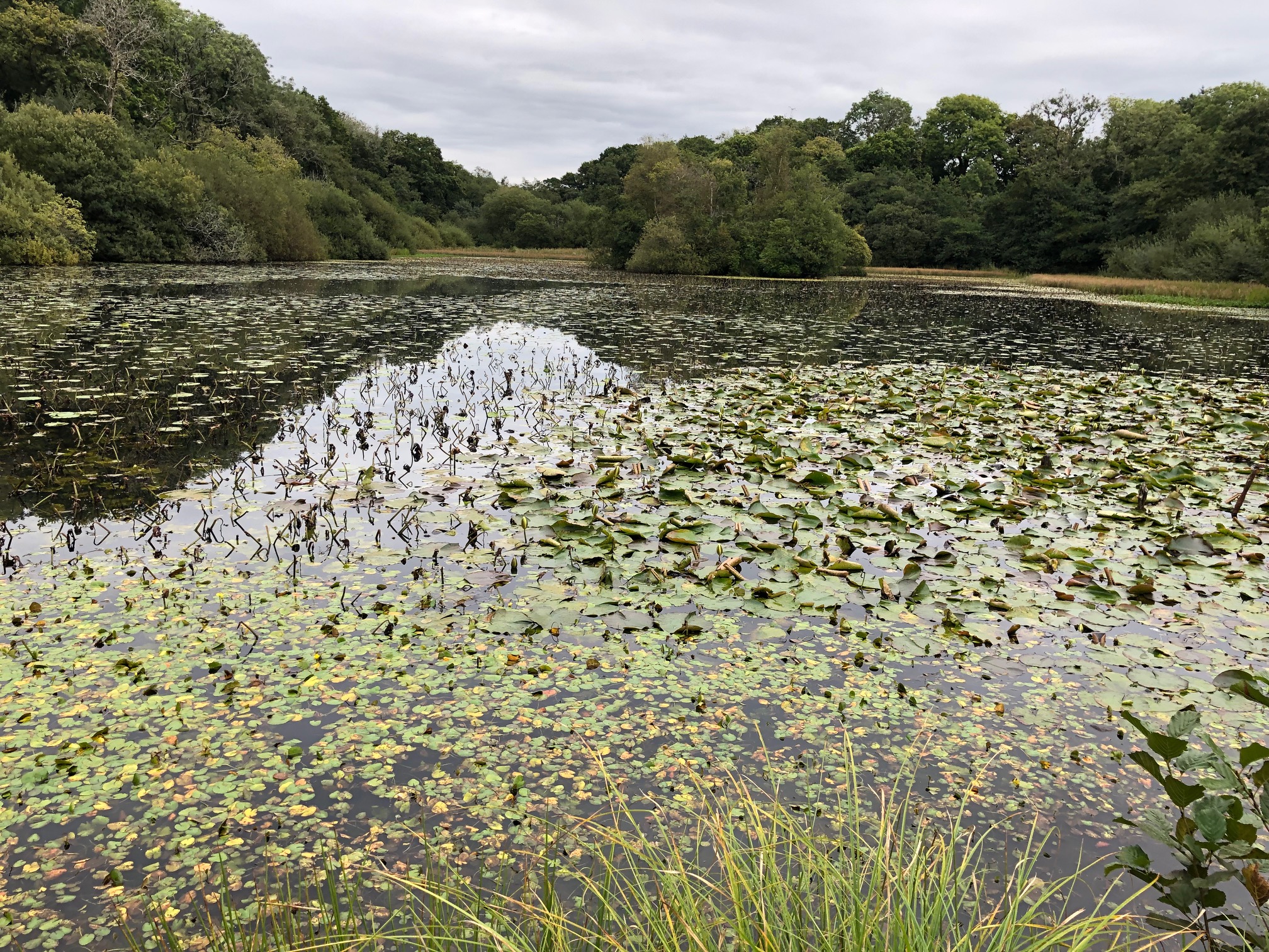
The path skirts the caravan park but soon dives into woodland, emerging at Fairwood Lake. This is a good point to linger and admire the lily pads on the water. Cross the dam and follow the path along the left side of the lake, again through woods. When it re-emerges you walk through luxuriant foliage on either side: today, blown rosebay willow-herb and vicious bramble fronds (but with ripe blackberries in reach). Now you come upon a surprise: a large flat green area protected by high fences and CCTV cameras, where Swansea City footballers train. The path begins to follow the fence, then veers to the right, across more common land, to Upper Killay. You pass a small lake inhabited by mallards and moorhens, with a nearby bench if you need a rest.

4 Upper Killay to Three Crosses
Leave the water and follow the street round to its junction with the main road. Turn left and follow the road for a short distance, until you see a terrace of houses at a tangent to it on the right. From here a handsome path leaves the village towards Dunvant, slowly losing gradient as it goes. To your left is the eastern edge of another common, Fairwood Common. Where the common finishes, turn left at a junction and follow the path that begins within a strip of woodland fringing the northern edge of the Common. At a footbridge an unmarked path leaves the main one and the trees, and strikes out left across the common. Following this lesser path leads to the Fairwood road by the signpost for Three Crosses (Y Crwys), just before the first houses. (If you stay on the main path, you’ll end up in the village itself, and will have a chance to explore it.)

5 Three Crosses to Cilonnen
Cross the Fairwood road and follow the track towards Gelli Hir farm (you’ve now joined the route of the Gower Way). After a while the path is diverted to the left and enters two large fields, to avoid walking through the farm and its buildings. Then it descends from the fields, crosses a farm track and winds its way up through woods to the other side of the valley. (Just south of here is Gelli Hir Wood, an old deciduous reserve, which is well worth exploring.) The path continues westwards, across another slice of common land, Mynydd-Bach-y-Cocs, presumably named after the cockles of the Burry Inlet, and joins Cilonnen Road. Turn left and walk along this quiet, straight road, past the roofless and crumbling remains of Carmel Chapel. You’ll notice that the farm- and house-names are now in Welsh (though a new modernist mansion has the tedious and inaccurate name ‘Channel View’). Opposite Pen-y-mynedd is a new bench with a view across the common, an inviting place to eat your sandwiches. A little further on, at Cilonnen, where another road joins yours, leave the road and the Gower Way, and take the path marked on the right.

6 Cilonnen to Penclawdd
The narrow, fenced path follows the sides of fields, until it reaches a view across a broad valley. Descend steeply across a large field, and then, after a farm, bear right cross the next one, (the gate out of it into a wood is well-hidden). The path soon runs parallel to a lane, first on one side, then on the other. Then it climbs through a large field towards a spired church on the horizon. This is St Gwynour’s Church in the parish of Llanyrnewydd, one of only two Welsh dedications to a sixth-century Breton saint; unfortunately, it was completely rebuilt in 1850. Walk past the church along a street that joins another by a converted Independent chapel, Capel Isaac. Turn left, then right and take the road downhill into Penclawdd. In the village, to reward yourself, try Caffi Cariad, a traditional café favoured by locals, or, if you need cooling, GGs Gelato.


Leave a Reply to Andrew Green Cancel reply