
There are places in Wales – places no one would call remote – that few people, even those living here, have visited, or even knew existed. Cwm Amarch, it would be safe to say, is one of them.
I got to Minffordd early enough – before ten o’clock. Normally, on a Monday in mid-September, you’d not expect to find many other people there. But 2020 isn’t a normal year, and the National Park car park was already almost full. I’d already being toying with the idea of an alternative route up Cadair Idris this year, and the ranks of cars made my mind up. The Minffordd Path is less satisfying if you have to share it with dozens of other climbers.

So I head down the road towards Llyn Mwyngil (Tal-y-llyn Lake), past the massive pillared beeches of the Dôl Idris estate. Just short of the water the road makes a sharp bend to work its way round the south side, leaving a gated farm track to continue the line on the north bank. Llyn Mwyngil is dead still, its water reflecting perfectly the trees on the far side. Above them rise the steep, scored slopes of Mynydd Rugog. About half way along the track you reach a farm called Pentre, where the path up the mountain begins. Pentre is an unhappy sight. The house was deserted long ago (there are some pitiful photos of the interior). It stands above its farm buildings, supported by a long and tall revetment of carefully laid slate. The barn is clearly ancient and rebuilt more than once (it seems to have escaped the attention of the Royal Commission). On the old telephone wires late swallows are gathered, ready to migrate once the warm spell is over.

Past the farm is woodland. Through it flows Afon Amarch, a modest river in this dry weather, but with a busy, lively stream of water. I’m in trees now, on what seems to be a path, following the river on its left bank. But then I can’t find a way forward, past the farmer’s fencing. I try moving up a steep hill to the left, but there’s still no way through, and eventual realise that the farmer has blocked the path. I go back down, climb over the fence and ford the stream. I’m free, in open country. It’s open, but it’s also frighteningly steep. To the left are the crags of Graig Ddu, and on my side of the river is Mynydd Pentre, a grassy hill that climbs at an alarming angle. I can see no proper path, and try to climb without straying too far from the course of the river.

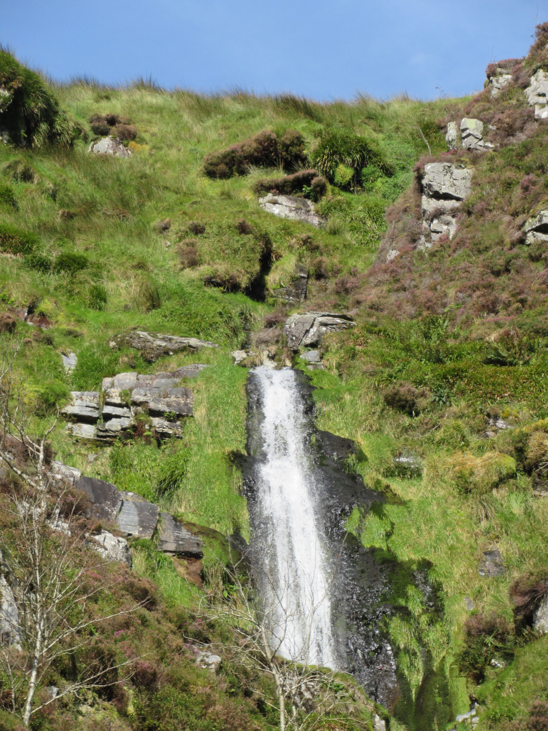
Within minutes I’m in trouble. The day’s hot and still, with no breeze. Forty years ago I might have been able to scamper up here, but now I need to stop every few minutes to catch breath and stop the heart thumping. The slope’s so steep I need to grasp fistfuls of grass to keep myself from falling back. It’s also mentally draining, constantly trying to find the next firm hold for the boots. After three quarters of an hour I’m beginning to feel exhausted, dizzy and uncertain of my balance, and slightly nauseous. I have to take even more frequent rests. I’m drenched in sweat and the water bottles are already worryingly low. Meanwhile the river bounces happily down the little valley, in multiple waterfalls, saving the largest and finest for the one at the top. A tributary watercourse, completely dry in this weather, joins from the left. At one point I surprise a group of sheep, who look startled and may not have seen many humans in this lonely spot.

‘Amarch’ seems to mean the same as ‘gormes’, so that Cwm Amarch is ‘the valley of oppression’. The river, though, is as cheerful a stream as you could wish for. Maybe the oppression suggests the mental and physical state of anyone rash enough to climb up its length on a hot autumn morning. Another, more common meaning of ‘amarch’ is shame or disgrace, which would be an apt description of my lamentable efforts on the slopes.
At last I reach the top of the highest waterfall, and the lip of Cwm Amarch. It’s such a relief to the body that I sit here for five minutes or more, trying to recover. I turn round and find the landscape has made a sudden change. Instead of the narrow river valley there’s a huge, open bowl of moor, the source of Afon Amarch, with the long wall of Craig Cwm Amarch ahead to the left, marching into the distance and merging with the ridge above Llyn Cau. I can just make out tiny figures of walkers on the Minffordd Path.

In my enfeebled state I find the next stage, climbing on to the ridge of Craig Cwm Amarch, almost as punishing as the ascent of Cwm Amarch. More stops every few yards, more draughts of the precious water. I’m reduced to hauling myself up by holding on to the wire fence to my left. Finally the slope begins to show mercy. I reach a small lake – just a high-level pond really – that I’ve noticed from afar on previous Cadair ascents. It has a curious likeness to a hotel infinity pool. There are views down into Dyffryn Dysynni far below, with Craig yr Aderyn (Bird Rock) and Castell y Bere visible through the heat haze.

The walking becomes easier, and before long I’m in familiar territory, below the summit of Craig Cau. I skirt the top and make for Pen-y-gadair and then along the mid-flank of Mynydd Moel. By now, under its dark cliffs, the surface of Llyn Cau is glistening in the late afternoon sun. Completely waterless, I pant down the side of Mynydd Moel towards Nant Cadair and the Minffordd Path, in the company of two young women. At the bottom we compliment one another on not having sprained an ankle, always a danger on the long, steep, rocky descent. One of them says they’ve recently climbed Snowdon, but now prefer Cadair. I can only agree.
Back at Minffordd, after several pints of water, I’m beginning to regain strength and composure. On reflection, I can see why the Cwm Amarch ascent doesn’t feature as one of the recognised routes up Cadair Idris. I’m glad I’ve managed to penetrate its quiet seclusion. Though I doubt I’ll be making the same journey again – at least in an upward direction.


Leave a Reply to Andrew Green Cancel reply