Ystrad Fflur (Strata Florida) is the official starting point of Teifi Valley Trail. At least it is if you’re walking from source to sea, which is the best way, unless you’ve mastered the art of reading guidebooks backwards. It isn’t the easiest place to get to, if you start out from Mumbles, as I have. But thanks to combination of car, train, bus – the swift TI service linking Carmarthen and Lampeter – and taxi, I’m able to arrive by coffee time and complete the ‘Teifi Pools Loop’, and its extension to Pontrhydfendigaid, by the end of the first day.

I’ve come to this task late. The original idea had been to walk the whole of the Trail as soon as it was opened, at the end of April, and to ‘road test’ it at the request of the organisers. But I’ve put the trip off several times, and now I’ve managed to make it coincide with the last and fiercest heatwave of this Summer of Fire. Already the heat is building.

A forest of scaffolding meets me at Ystrad Fflur, a sign that the restoration of the stable block of Mynachlog Fawr is soon to start. It’s the latest of a series of works by the Strata Florida Trust to restore the historic farm and outbuildings, next door to the remains of the Cistercian abbey. I call in at Y Beudy, the Trust’s HQ, and chat to C. and M., friends from my time on the Trust’s Board, and catch up with their news. Then I visit the exhibition space, Tŷ Pair, and the abbey reception and shop, both staffed by volunteers. What I don’t do is something I’ve done on most visits here, which is to sit quietly in the walls of the abbey and let the special tranquillity of this place work its magic. The Trail, and the source of the Teifi at Llyn Teifi, demand attention.

The Teifi Pools Loop begins on the narrow road that borders the large cemetery of St Mary’s Church, next door to the Abbey – the one that contains the remains of Dafydd ap Gwilym, according to some, and the tombstone that marks the interment in 1756 of the left leg of Henry Hughes Cooper (the rest of him ended up on the other side of the Atlantic). Between the gravestones I can see Glenn Morris’s Pilgrim – the second, steel statue, not the original wooden one – leaning on his stick as he strides purposefully against the wind and across the hill in the distance. Soon, trees line the road, giving relief from the pitiless sun. I pass a water works, and already feel anxious that I’m not carrying enough water, even though two full bottles are weighing down my backpack. Colour has seeped out of the whole landscape, except for the premature red splash of rowan berries by the roadside.

Before very long the valley ceases to be pastoral – sheep lying asleep in the shade of trees – as the mountain foothills press in on both sides of the road. Small roadside watercourses that carried streams a couple of months ago are now just chutes of dry stones. I disturb a red kite just ahead of me. It lifts off and rejoins the thermals above (there’s a slight breeze now as the road climbs), the first of many kites I’ll see over the next few days.

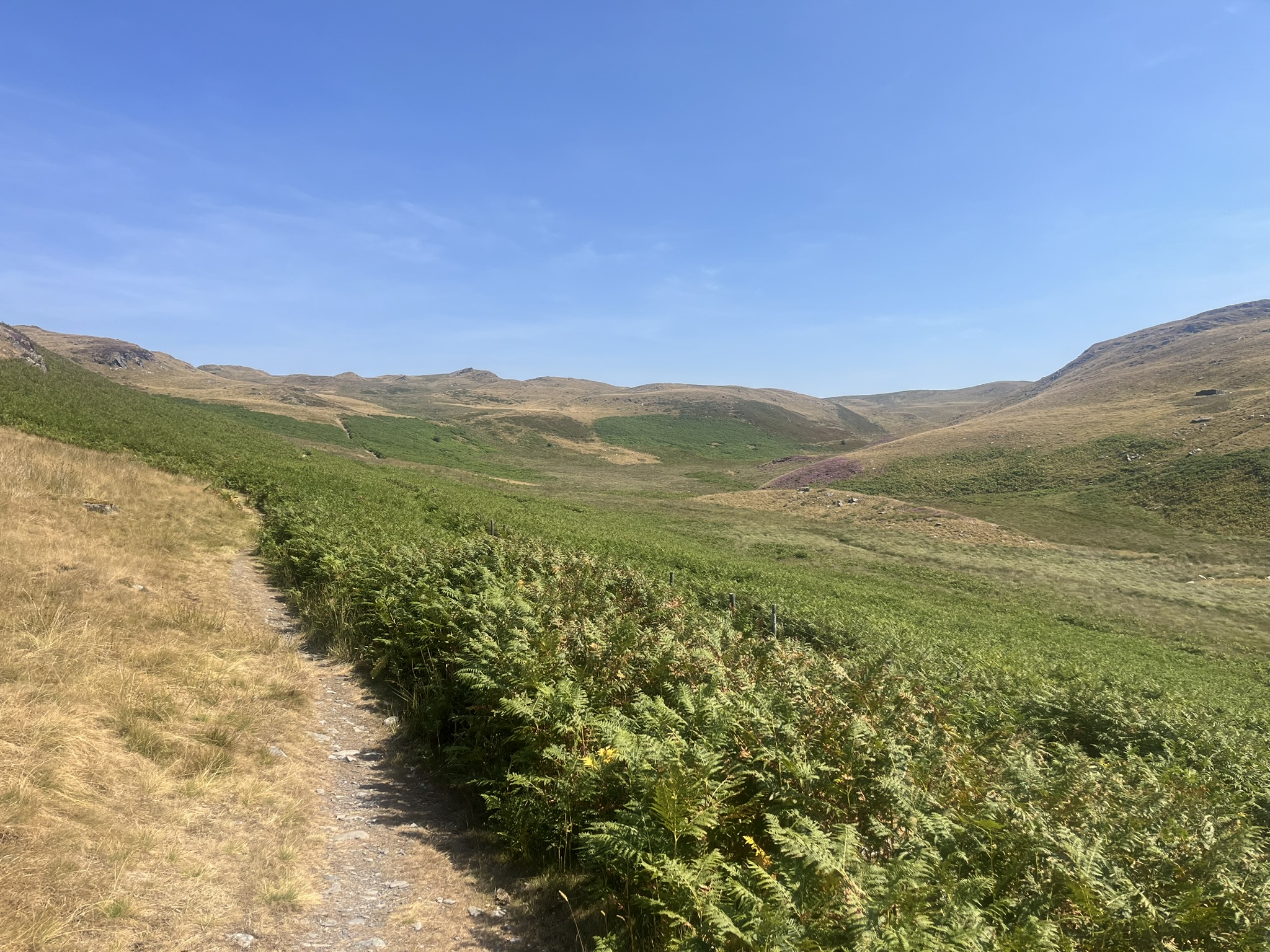
Before the last farm, Tyncwm, a path branches off to the left into Cwm Egnant, and starts its steady climb. At first, Nant Egnant is low to my right, then on the left. I pass a sign making the halfway point of the Cambrian Way, which temporarily shares the route. (Tackling the Way, which links Cardiff and Conwy by means of the highest mountains and hills it can find, is probably now beyond my failing physical powers.) By the time the path and river swap places the landscape has changed. The hills, covered in bracken, purple heather and scree, have been evened out by glaciers into a denuded plateau.

There’s something primeval about this wilderness-like upland world: the way the bare hills seem to be moving in slow motion, rolling into one another in every direction; the absence of trees, birdsong and people; the parched grasses; the numerous hillocks that suggest huge tumuli. You could almost be on an alternative planet – except for the many sheep, calling to one another across the valley. In fact, the landscape would probably look very different, less alien, without the teeth of the sheep. The Cambrian Mountains used to be known as Wales’s ‘Green Desert’, but that was before heat and drought abolished greenness. Today, the predominant colour is a straw-like yellow-brown.

Beside the path are short, rotted wooden posts encased in stones, presumably way-markers from an age when snow used to fall, obscuring the route. Beyond a wayside cairn the climbing ends and the path descends to the concrete dam at the south end of Llyn Egnant, the easternmost of Llynnoedd Teifi and the lake preferred by anglers for the quality of its wild brown trout. In the shade of the dam several sheep are sheltering from the cruel sun. Close by lie the scattered remains of some now unidentifiable vehicle. Picked clean by the elements, they look as though they’ve escaped from a surrealist painting.

Welsh Water’s access road starts from the dam and follows the west bank of Llyn Egnant. Just before the end of the lake, up from the road, is a vertical rock, and on it an inscribed plaque to the memory of Moc Morgan, an expert fisherman, naturalist and frequent broadcaster on S4C, who died aged 86 in 2015. He was born in Dol-dre, Tregaron. The Teifi was his favourite river and Llyn Egnant one of his favourite haunts. I take out my sandwiches by Moc’s side and as I munch them I join him in contemplating the view of the lake and hills ahead, the ‘paradise’ mentioned in the lines on the plaque, composed by Eirwen James (‘E.J.’):
Dyma baradwys Moc Morgan
Llyn Egnant, y glain arian,
Hafan pysgotwr o fri,
Llonyddwch Llynnoedd Teifi.

The track leaves Llyn Egnant and moves north and west, to join the parent road from Ffair Rhos. This passes the top of Llyn Hir, as it rollercoasters from left to right and up and down in this strange post-ice age land, until it meets an approach track down to Llyn Teifi. The guidebook tells me to pass the locked gate guarding the dam, but it doesn’t mention new Welsh Water ‘danger, keep out’ notices. These look discouraging. But there seems no other way, so I open the gate and disobey. At the dam there are clearly major engineering works in progress. Giant pipes and piles of bagged stones lie next to a newly built track. It’s not clear where to go next, but eventually I find a signposted path below the dam that leads to the infant Afon Teifi, newly released from the base of the dam. The guidebook says this is the last point at which you can ford the river, but this summer that can hardly be true. I look up, startled by a mechanical sound, and see a large JCB trundling along the new track bearing a heavy load. I’ve made my escape just in time.

Now I’m in Cwm Teifi, a narrow valley with hills on either side. This is wild territory. Sometimes there’s a path, sometimes there isn’t, but it’s clear enough where to aim for, keeping the tiny river to my right, until I reach Frongoch. Swallows flit and scream around the ruined farmhouse. Further down, I reach a wood, with the river far below me in a ravine, and then pass a farm, Penddol Fawr, before rejoining my original road next to the water works.

Back at Ystrad Fflur I call in again at the Beudy to report my safe arrival, refill my water bottles and set out on the final, challenging stage of the day, to Pen-y-bannau. By road it’s less than a mile to Pontrhydfendigaid, and the guidebook does offer an alternative path there, parallel to the road. The ‘proper’ route, though, is much harder and circuitous. As a purist (and puritan) I can’t resist taking it.

First, I cross the Teifi on a small footbridge near the cemetery, and then a series of large fields. In the first, a red kite circles high above me, slowly shifting its spirals eastwards as it scans the land for possibilities. It seems to need almost no physical effort. By now the accumulated heat reflected from the burnt earth must be generating its own upward air movements.

Field succeeds field, each one getting steeper and sweatier in the climactic late afternoon sun. On the left are the remaining stone buildings of the old Abbey Consols lead mine, and around them runs a rudimentary racetrack littered with old tyres – an attempt at diversification by a local farmer that strikes a discordant note with the silence and tranquillity of the old abbey. The fields continue upward, until finally I find myself on a large open moor, Rhos Bronyberllan (was the original perllan or orchard began by the Cistercians?). Here more swallows are darting over my head, and later on I spot a buzzard and hear its cat-like mewing. Still the sun beats down, as the path crosses the parched rhos until it reaches the tall (252m) hilltop in the distance.

This is Pen-y-bannau, and on its summit is a small but well-defended trivallate hillfort, presumably dating to the Iron Age. Passing though gaps in the ramparts I reach the trig point at the fort’s centre, and finally understand why the guidebook has brought me here. A panorama suddenly opens up, with huge views down the valley and in whichever other direction you turn.

Saying farewell to the hillfort, I turn left and follow the route towards Pontrhydfendigaid. At the foot of a steep drop through fields, the path hides itself in a straight sunken track bordered by gnarled trees, before emerging into the eastern end of the village. I make for the Black Lion, where I’m staying the night. Unpacked and showered, I sit quietly in its back garden and read. I’m travelling light, but there was room in my backpack for one small book. It contains Matsuo Bashō’s account of his five-month trek of 1,200 miles through northern Honshu in 1689, The narrow road to the deep north.

Bashō is my impossible-to-attain model of what a walker should be: open to the simple but intense pleasures of nature he encounters, respectful of those who lived and who wrote in the lands he passes through, aware of the transience of all things but also of what survives. As he travelled, Bashō wrote short poems, hokku, and pen and paper were part of the meagre possessions he carried with him. Even these seem a heavy burden, since, although he’s only in his forty-fifth year, he ‘has in recent years grown old and infirm with hoary frost upon his eyebrows.’
When I reached the village of Sōka in the evening, my bony shoulders were sore because of the load I had carried, which consisted of a paper coat to keep me warm at night, a light cotton gown to wear after the bath, scanty protection against the rain, writing equipment, and gifts from certain friends of mine …
Inside the Black Lion the owner, A., serves me cawl, my absurdly wintry choice for a hot summer evening. She asks me whether I’d noticed an acrid smell in the air. Wildfires are raging in the Elan valley around Rhayader, and smoke is beginning to drift across the mountains and down into the Teifi valley. There will be worse to come.

Leave a Reply