
At nearly seventeen miles this is going to be our longest day, so C, M and I set out early from Buttington Bridge. It’s already raining steadily. The path takes us along the towpath of the Montgomery Canal, no longer navigable and the preserve of great sheets of algae rather than narrow boats. We pass a neat lifting bridge across the water, and the site of Strata Marcella Abbey. In the early thirteenth century Strata Marcella was the largest Cistercian abbey in Wales. Not a trace of it survives above ground today. Some attractive floor tiles were uncovered by Stephen Williams in his excavations in 1890, and the Abbey’s Charter survives in the National Library of Wales.

At the lock at Pool Quay the path turns right to the main road, a hellish whoosh of fast heavy lorries, and becomes a riverside walk along the river Severn, through fields of long wet grasses, so that the heels of our boots throw up sheets of water as we trudge downstream. The only comfort is that the wind has veered westerly since yesterday, and we’re no longer battling against it. We realise we’re following in the footsteps of the remarkable Ursula Martin, the champion of Welsh walkers, who followed the course of all the main Welsh rivers from source to estuary. Across the valley comes the solid thrum of traffic from the main road, but other sounds too, including the call, above our heads, of three columns of geese making for the east. Low rainclouds hide the tops of the Breiddin hills, the easternmost one half eaten away by quarrying.

Field succeeds field. Sometimes the way out is obvious, along the tops of flood embankments, sometimes not. Conferences of cows sometimes block our way and need to be walked round. We meet a man in shorts carrying a large backpack, who’s tenting his way south, and a runner who passes us in a flash (her daughter parks a camper van at each of her destinations). Just as we’re ready for a break and in need of a bench, we open a gate and find a strip of closely mown grass, and then, outside the first house we’ve seen so far, three metal chairs and a table. We give thanks to the invisible providers, and before leaving we leave a message of gratitude on the slate usually used to advertise their homemade cupcakes. Five minutes later C realises he’s left his walking sticks at the chairs. He arrives back in the company of the Spring Heeled Jacks, the couple we last saw disappearing over the horizon in front of us two days ago.

Finally we lose the river, cross a side channel over a metal sluicegate and move inland, reunited with Offa’s Dyke, towards the straggly, by-passed village of Four Crosses. Here we lose our way and sense of direction, wandering from mini-roundabout to mini-roundabout in search of food (pedestrians aren’t much welcomed here). At last we find a shop, and a bench to eat our lunch. As we eat, the Spring-heeled Jacks pass us: they seem to know how to get out of the village. In the end we too find a way out, via a road underpass, which features two quirky murals by Ingrid Maugham and Karen Geddes that tell the history of Four Crosses: they include a plaque celebrating Walter Clopton Wingfield (1833-1912), the inventor of lawn tennis and various bicycles, including the ‘Butterfly’. In 1897 he published Bicycle gymkhana and musical rides, which sounds like a good read.

Next we return to the Montgomery Canal, which follows an indirect, looping route to Llanymynech. Walking the towpath is a tranquil experience, among the bordering trees, bending towards us in the wind, and the canal’s reeds and algae. Swans hoover up the algae that cover large expanses of water, with an industrial, Dyson-like noise. A well-bearded man with a small dog asks us if we know of any local walks (we plead ignorance: we only know national ones). We cross a spectacular aqueduct across the river Vyrnwy – it cost 6% of the canal’s total cost in the 1790s – and pass the two locks at Carreghofa, the second bordered by an ancient, much changed house and handsome waterside garden.

Llanymynech is un-bypassed by the main A483 south-north road, and we sit on a bench watching the unending traffic thunder pass the sign marking the Wales-England border, before finding the energy to climb Llanymynech Hill. Ahead of it is the scattered village of Pen-y-Foel, where Charles Darwin came in 1831 to teach himself geology. Then there’s a steep ascent to the much-quarried rocks at the top of the Hill, along a straight track used to transport the quarried limestone down the hill. The quarrymen christened the different strata: Gingerbread Bed, Blood Vein Bed and Croen Diawl (Devil’s Skin). Thomas Savin, who came from Oswestry and played such an important indirect role in the founding of the University College in Aberystwyth when his new Castle Hotel went bust, owned the quarry. He seems to have been an unlucky man. An information panel tells us he once used an exceptionally large quantity of explosives, in order to release a month’s worth of stone in one day, and was forced to compensate local residents when their windows were shattered and roofs blown off.

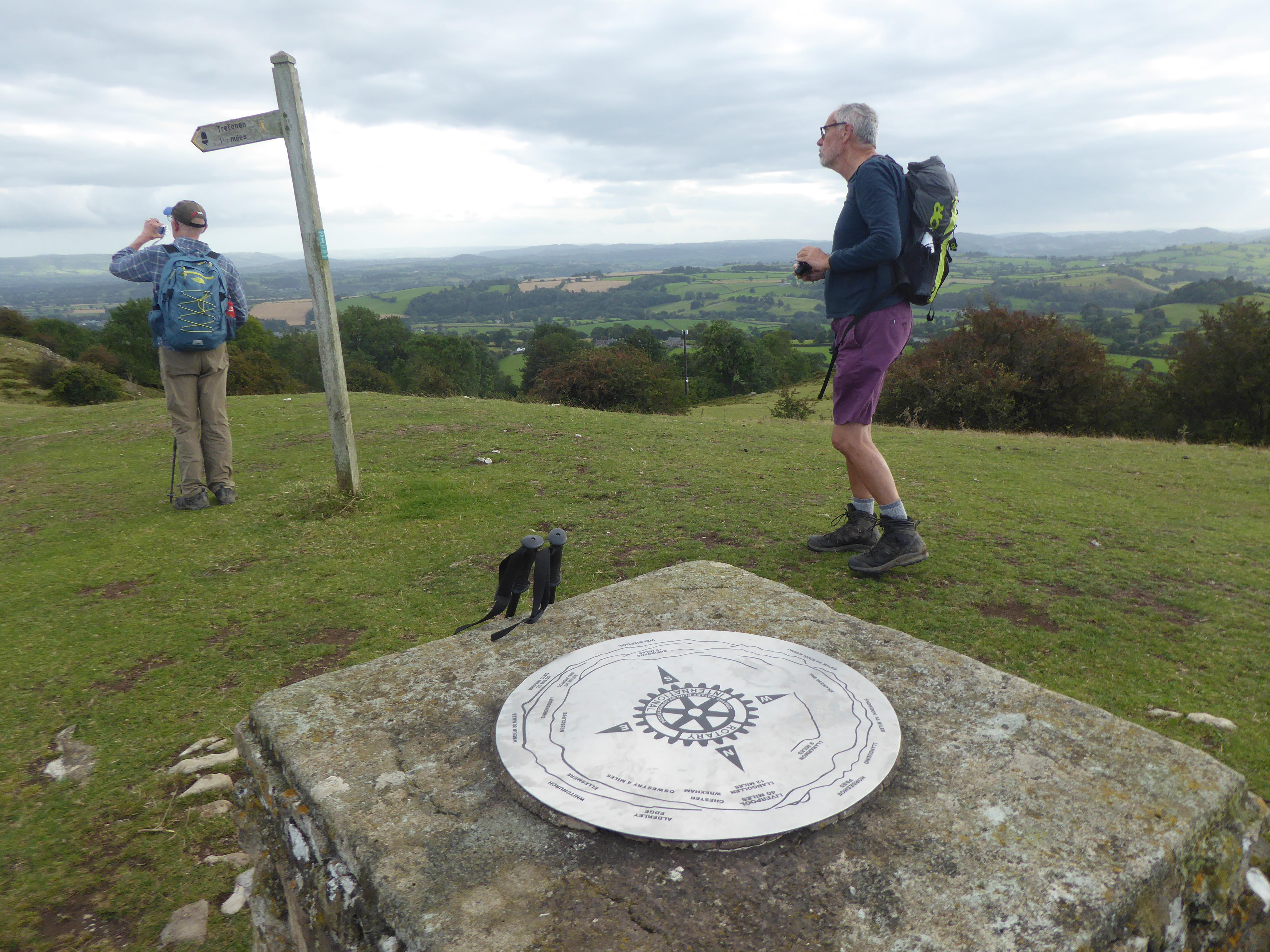
We’re rewarded, beyond the quarry, by a stretch of level walking, with fine views west, and reach a high-level golf course. The full-bellied middle-aged men on the greens have surely not arrived the way we came. The path drops through woodland to Porth-y-Waen, crossing the long-disused Tanat Valley Railway (though amazingly the track is still in place), and we stroll along narrow lanes to the village of Nantmawr. Next we take a path up the hill to the north – ‘a very steep pull’, says the guidebook – and rest on a bench with another fine view. (Today has been a day of astonishingly well-placed seats.) We climb again, through Jones’s Rough, now a nature reserve, and make another remarkable find – a kind of rustic adventure playground, with two swings, a picnic bench and some old stone ‘play-houses’. After a swing and some dried mango we keep going up, and finally get to the summit of Moelydd (‘Mount Baldy’?). This is only 934 feet in height but has a startling panoramic view. The toposcope tells us we should be able to see the Berwyns and Cader Idris to the west, and Alderley Edge and the Wrekin to the east.
We’re due to be picked up by taxi at Trefonen, so we hurry down the north-western side of the grassy hill, along lanes and across fields to the village. We’re staying overnight in Oswestry, a town full of interest, though long since deserted by the railway network and by-passed by most traffic.
Leave a Reply