
Today was due to be rain-free, and it is. This fact alone lends us a lightness of spirit that lasts all day, another long one. We’re joined by our guestwalker and friend A., fit after his holiday in the Italian mountains. A taxi returns us from Oswestry to Trefonen. We’re immediately unable to find the resumed Path, and have to interrupt a surprised hedgecutter to ask for help. This isn’t the last time we’re in trouble in the first hour: at one point we completely miss a stile and blunder on up the road until we realise our mistake. The main problem is that we’re deep in conversation and our navigational antennae are asleep.

A straight stretch follows the Dyke and then we’re back to pain: a steep climb up Candy Hill through woods. They continue along a ridge for miles before emerging on to a disused racecourse. In the late seventeenth century there was a fashion for building racecourses in high-level locations. This one featured a grandstand, the remains of which survive. Fortunes were won and lost here. One man of fashion, impressed by a win, named his son after his favourite horse, Euphrates. Today dogs, rather than racehorses, are led around the course.

The Path eventually rejoins the Dyke, then, at the curiously named Orseddwen farm (we’re still in Shropshire) leaves it for what seems to be an old drovers’ road. We climb steadily, continuing north, all the while with enormous views across the plain of the English Midlands. Though visibility isn’t perfect, we can make out Alderley Edge and the Pennines behind, and what looks like the chemical plants of Runcorn. We meet a man and a woman carrying large sketchpads: they’re in search of ancient monuments to draw, but, they say, a frisky heifer has scared them off tackling a standing stone. There are few fellow-walkers, except for a group of well-scrubbed youngsters we suspect are evangelical Christians. We stop for a break, looking out over the Shropshire plain. All morning we’ve been deep in conversation, about all manner of topics: the history of barbed wire, the malign effects of Boris Johnson’s classical education, the Chinese President’s ambitions for his country, and the cognitive capacity of sheep.

Chirk Castle comes into view, imperious and white above a steep green slope. Roger Mortimer, one of the most ferocious Norman Marcher barons, build the first castle. Today, another powerful interest, the National Trust, is the landowner. The path is interrupted at Nanteris, where a miserably small stream has cut a deep gulch, painful to the knees, and then again by the Ceiriog valley. At Bronygarth we sit on the high wall of the stone bridge in the sun to eat our sandwiches, as the water rushes by far below. There’s a metal plaque on the bridge wall commemorating the victory of the Welsh against the invading forces of Henry II at the Battle of Crogen in 1165.

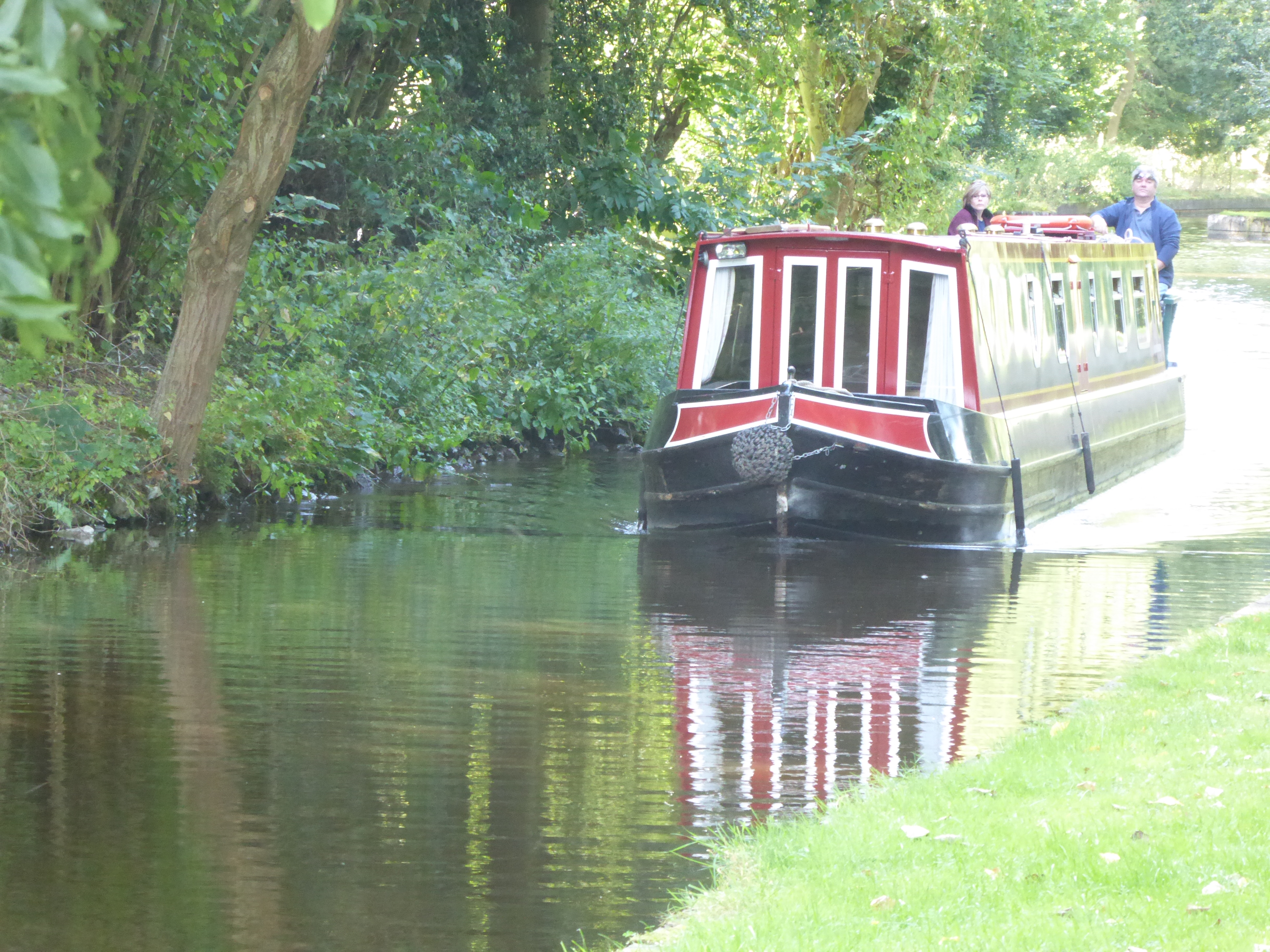
Next, more climbing, with views up the incomparable Ceiriog valley, until we emerge in the grounds of Chirk Castle and start to descend, saying a final goodbye to Offa’s Dyke as it moves off eastwards. At the bottom of the slope the Path has difficulty finding a bridge across the Llangollen Canal, but finally succeeds, and in the early evening we wander along the towpath towards Froncysyllte, stopping at an ice-cream barge for refreshments. Suddenly we’re in tourist-land. Sedate dogwalkers stroll, and well-painted rented barges edge along. Then, round a corner, we see the long straight stretch of the Pontcysyllte aqueduct, one of the wonders of Wales. None of us had ever walked across the top of it before, and the experience is thrilling, like floating through clouds in a dream. The river Dee and its fields lie over 120 feet below, and the shadow of the arches is stamped on the bordering trees. Barges and pedestrians saunter slowly along, as if walking in the air were perfectly normal.

For a short while we follow the canal in the direction of Llangollen before starting to move up the northern side of the river valley, through the Plas Trefor woods. The path takes a high-level route through coniferous trees. M asks if I can hear a constant hum overhead, like bees. I say I’m glad he’s asked, because I was wondering whether tiredness was causing me hallucinations, but we have no explanation. Then we’re out of the woods, climbing again on a zigzag limestone track, and suddenly there’s Castell Dinas Brân ahead. The castle ruins, on top of their steep conical mound, are silhouetted against the sky as the sun begins to decline behind them. We’re too tired and out of time to climb up – maybe tomorrow morning? – and instead we walk along a narrow lane that drops down to Llangollen and deposits us in the centre of the town.
Leave a Reply