On an imaginary bridge across Môr Hafren we’d have arrived here in much less than an hour. As it is, we faced a car journey of over four hours. Add the fact that neither of us has been here before, and the result is that this spot in north Devon seems remote and exotic. (C is here on an art course, and I have nothing better to do than write and walk.)

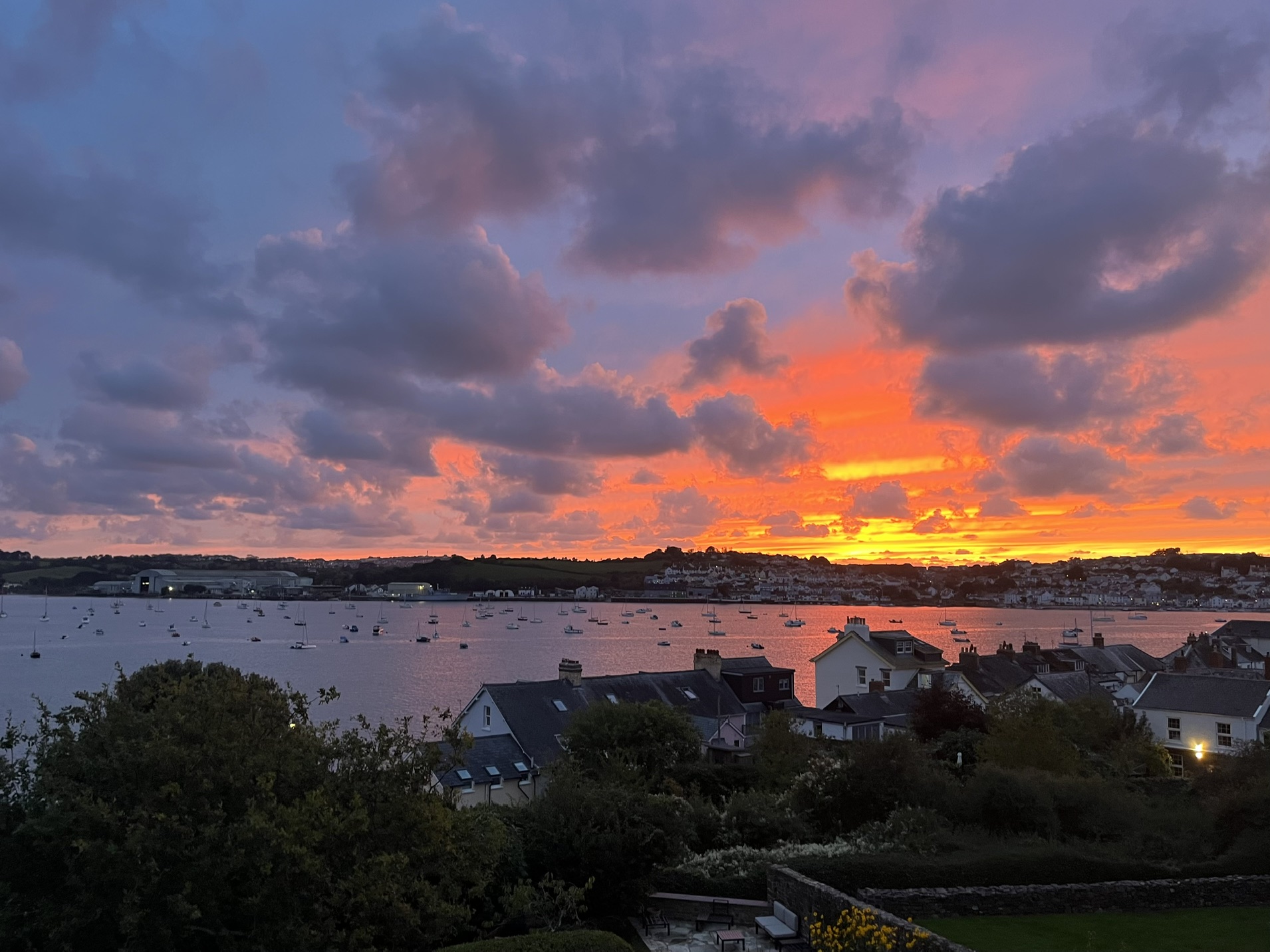
The village of Instow lies near the point where the rivers Taw and Torridge join and make for the sea. Water is at its heart. From our attic flat we’ve a fine view of the Torridge. On its broad, sheltered roads dozens of small boats lie at anchor. At high tide – the Severn tidal range is large, of course –they’re all afloat and look like a miniature flotilla, acting under single command; at low tide most of them flop from the vertical and lose all sense of order and connection.

Across the river is Appledore, a larger village. Coloured shops and other buildings are strung out along the quayside and behind them narrow streets climb the steep hill. While Instow grew as a resort – it has several pubs and one hotel called the Commodore – Appledore has a longer history as a fishing village and a boatbuilding centre.

We explore Instow in the evening, almost as soon as we arrive. The main road to Barnstaple climbs inland, leaving the waterside lane as a quiet, mainly pedestrian promenade. The village once had a railway station, on the line linking Bideford and Barnstaple, and relics of it have been reverently preserved: a signal box, platform, a section of rails, and two crossing gates. There’s a general air of quiet contentment. This is a place for a gentle stroll on the sands beyond the dunes, preferably with a couple of dogs, followed by a pint in one of the pubs. There’s also a smaller, older settlement, Instow Town, on the hill above. It has a church with a tall, thin tower, several old houses clustered round it, a ruined windmill and a white ‘leading light’ tower to aid estuary navigation.

Next day I install myself and the laptop in a window with a view across the estuary, and then walk up the Torridge to Bideford, along the track of the old railway line. It’s a busy route, shared by cyclists and walkers, and forms part of what’s called the Tarka Trail. The title’s awkward. It’s an obvious choice, since Tarka the otter, once considered a children’s classic but less read now, is set in this area. But there’s no escaping the fact that its author, Henry Williamson, was, and always remained, a convinced fascist and anti-semite. He held a deep admiration for Adolf Hitler and in 1937 joined Oswald Mosley’s British Union of Fascists. (In England they have a weakness for misnaming long-distance paths: the ‘King Charles III Coast Path’ might have been specially designed to enrage republicans.)

Walking on the tarmacked railway track is easy enough, but it can be hard on the feet. I move from one side of the track to the other to vary the camber, but when I do I cast an eye over my shoulder in case silent, speeding cyclists are coming from behind. To my right is the river, its near bank dotted with resting or rotting ships and mysterious razor-wired installations labelled ‘Ministry of Defence: keep out’. (The strong military presence in these parts dates back to the Second World War and rehearsals for D-Day.) I cross to Bideford by the ‘Long Bridge’ and explore the town. It’s an attractive place, with a waterfront that seems vaguely French and a steep high street behind it. The Burton Museum contains a ceramic collection put together by a local artist, R.J. Lloyd, which reflects the long local tradition of making pottery, in mixed vernacular and craft styles.

Next morning I explore the coast path north of the village along the river Taw. Past the sand dunes are brightly-painted chalets, and then a cricket ground with an old pavilion and scoreboard, both topped with thatched roofs. It’s low tide, and creeks leak water across mudbanks towards the river. The path snakes through more sand dunes, and before long I spot a long, abandoned concrete jetty near Yelland. It once belonged to a large coal-fired power station, demolished in the late 1980s after Margaret Thatcher shut the mines and coal could no longer be ferried across the Channel from south Wales. Behind tall screens earthmovers trundle over the bare site. Anonymous signs fixed to the screens try to reassure passers-by that the developers of 250 homes planned there are somehow going to be safeguarding nature.

From Easter to October a ferry, run by volunteers, runs between Instow to Appledore when the tide allows. Late in the afternoon I catch it, together with a couple who are walking the whole South West Coast Path (are they cheating by catching the ferry?). I wander through the village, the ‘Dark Side’, according to one of the ferrymen, since it faces north. Appledore is a place of pubs, cafes and small art galleries, and has a second-hand bookshop and a literature festival. But its most striking feature is the grid of streets of terraced cottages that climb the hill. The streets are so narrow that most of them won’t admit even a small car. When it rains, water flows down a shallow channel in the centre. Some of the streets are dead ends, which adds to the tranquillity. At the top of one I ask one resident what it’s like to live in a carless street, and she says, ‘bliss’.

At the south end of Appledore, behind a high wall, is the old dry dock, abandoned and overgrown. Through the ornate gates, labelled ‘Richmond Dock’, I can see an ancient crane, rusted into immobility. An investor has bought the site, with the intention of developing it as a maritime museum, including a German e-boat, but has met with local opposition. Shipbuilding continues in a huge covered dry dock a little further upriver, now owned by Navantia and used mainly for military purposes. Back in Instow, the day ends with an angry red sunset over the hills above Appledore.

It’s the Tarka Trail again on the following day, but this time to the north, past the creeks and marshes of the Taw plain. Some of this land is protected by the RSPB and the Gaia Trust. Half way along I happen on a coffee shop (flapjacks recommended) at Fremington Quay, once a port and another landing point for coal and culm from south Wales. Nearer to Barnstaple oystercatchers and curlews are feeding in the shallows and on the sandbanks of the river, almost as far as the Long Bridge to the town on the opposite side.

Another sunny day, and I take the bus to Bideford to try another section of the Tarka Trail, upriver to Great Torrington. By now the Torridge has ceased to be tidal, and Trail follows its course, crossing it on bridges several times as it meanders along the valley. Alas, the main road also follows the river closely, and it’s busy with noisy traffic. I stop on the bridges to peer down into the water, where groups of large fish are circling one another: a heartening sight.

Leaving the Tarka Trail I cut across on a bridleway towards Great Torrington. From Taddiport Bridge the approach to the town centre is along the exceptionally long and steep Mill Street, lined with old, cheerfully painted terraced houses, and with a raised pavement separated from the road by old metal railings. Without being at all chic or pretentious Torrington is a town of great character, with old-fashioned shops, including two greengrocers, a ‘pannier’ market, a Town Hall, a large church surrounded by cobbled pathways, and an archaeological dig on the site of the castle. It’s surrounded on three sides by commons, preserved as public spaces, and has wide views over the river and hills to the south – and some curious long fields, apparently farmed by people suffering from leprosy who were kept in isolation in Taddiport. Great Torrington lost its rail line long ago, and it’s hard imagine a time when the wonderfully named Atlantic Coast Express ran direct from London Waterloo.

The town is used to insurrection – in a battle in 1646 Parliamentary forces led by Fairfax kicked out the Royalists, who fled to Cornwall – and it’s currently in the national news for another conflict. Its residents find themselves in the front line of the gathering resistance of ordinary people to the arrogance and might of the tech billionaires. Almost every building in the town shows a poster protesting against a plan to build an 850-acre AI data centre and battery energy storage system (BESS) on a UNESCO biosphere reserve outside the town. Much secrecy surrounds the plan and the involvement of the local authority, which has only inflamed public feeling.

On the final walking day (no sun but a strong warm wind from the south) I start from Bideford again and take the coast path north on the west bank of the Torridge to Appledore and Westward Ho! The river path is tacked together from numerous short paths, sometimes near the shoreline, sometimes not. At Cleave the residents, at the end of their long drives, seem fearful, if not paranoid, to judge by the number of notices: ‘private’, ‘keep out’, ‘CCTV in operation’. Nearer to Appledore a diversion is needed to avoid the Navantia dock. The village has a northern suburb, complete with the same narrow streets and cheerful cottages as in the centre. Then the path turns west alongside the Skern mudbanks. At one point the path has been closed; the notice says, ‘we apologise, there is no alternative’, so I disobey and continue.

Back on a lane, I’m passed by workers from South West Water and the Environment Agency, who wade out to investigate an outflow pipe – on the day South West Water is fined almost £8m for illegal sewage spills in Cornwall. Then there’s a long but magical detour round the watery edge of the Northam Burrows, a protected environment notable for its clumps of ‘sharp rush’ (Junctus acutus L.), a coastal reed equipped with fatally sharp spines. I can’t see them, but curlews are calling in the distance. Soon I’ve left the estuaries behind and I’m on the sea shore, a long bank of pebbles backed by dunes and fronted by an expanse of golden sand.

Victorian developers eyed these sands and sized up their chances of developing a new seaside resort. They came up with a dazzling idea to attract investors, one of the earliest wholly successful branding exercises. In 1855 Charles Kingsley had published his chauvinistic novel, Westwood Ho! The book, partly set in the Bideford area, was a huge popular success. Kingsley had borrowed a cry of Thames boatmen, ‘Westward Ho!’, for the title of his story, about imperial adventures in the Caribbean. The developers adopted his title in 1865 for the name of a hotel in their new Devon resort, even retaining Kingsley’s exclamation mark. Villas, terraces, churches and other amenities followed, and the whole settlement quickly became known as Westward Ho!

Today Westward Ho! has all the features you’d expect of a seaside resort: amusement arcades, ice cream vans, cafés and chip shops, a prom with chalets and the slow walking pace of elderly, out-of-season visitors. Most of the Victorian buildings have vanished or are in ruins. The tall terrace blocks that remain look rather grim (Rudyard Kipling went to school in one of them, and was unhappy there). In their place are modern flats and shops of poor architectural quality – so poor in the case of one recently built block that it’s awaiting demolition. One of John Peel’s favourite bands, Half Man Half Biscuit, seem to have captured the place well in their song ‘Westward Ho! – massive letdown’.

With the expedition to Westward Ho! my week of walking is almost over. I feel I’ve done enough to gain some idea of the country round Instow. The area might lack big hills, but it has fine walking and cycling in all directions. It’s estuary landscapes are special, and need to be preserved and loved.
I also like the tang of rebellion in the north Devon air.


Leave a Reply