 The rain has stopped, and none is forecast for the rest of the day, as six of us wait in Beaumaris for the bus to Llanddona. The driver looks dubious. ‘Llanddona? Are you sure? There’s nothing there’. But we are sure and he lets us on. We get out by the pub and the public hall in the village and walk down the steep, single-track lane to the car park at the southern end of Traeth Coch (Red Wharf Bay). At first the path follows a lane parallel to the coast but then climbs up the hillside and we see no more of the sea until Penmon. We pass a pair of walking shoes, lying neatly on two concrete slabs above a pit, and hope their owner doesn’t lie below. Looking back we’ve views up the coast to Benllech and Moelfre.
 In the absence of a truly coastal path the planners have pieced together an ingenious route from short stretches of path, over fields, down obscure lanes, through dark copses, along farm tracks and through open country. There are no villages, just farms and cottages scattered along the narrow lanes. Some are unreconstructed, but many have been gutted and gentrified, and too many are rentals or second homes. We climb up towards Bwrdd Arthur and then wind slowly down towards Penmon. Only a few other walkers meet us, and we stop now and then to pick blackberries, the plumpest and sweetest we’ve ever eaten. The land here is rich and the grass luscious: the cows and horses look well-fed and sleek. No wonder the island was long known as ‘Mam Cymru’. Swifts and swallows scream and dive and gather on telephone lines, waiting for the signal to start the journey to north Africa. The kissing gates self-close with the aid of a block of native limestone suspended from a rope, a prehistoric technology fitting for such an ancient countryside. We pass an old farm, unmodernised and with its original barn and other outbuildings, and a schoolhouse built by the Calvinistic Methodists, where generations of children would have been treated to the sternest sermons. Now the Carneddau across the Strait come into view, clouds shrouding their summits.
 It’s taken longer than we expected to reach the windmill and then the lighthouse at Penmon, but our pace quickens when we meet two walkers who report that the Pilot House Café at the tip of the promontory opposite Ynys Seiriol is open and serving large portions of food. After the rest we set off along the lane to Penmon Priory, with its eighteenth century dovecot – a Premier Inn for pigeons, able to house almost 1,000 of them at once – and the priory church, with its shelagh-na-gig figure and two medieval crosses. I deviate to visit St Seiriol’s Well, a plain rectangular pool of water set into an elaborate eighteenth century grotto. Next to the priory is the Bulkeley family’s large deer park, surrounded by its tall limestone wall, and looking back we see the limestone quarries and docks for exporting building stone – all now in ruins. Tiring of following the road, the Path deposits us on the pebbly beach, below low crumbly sandstone cliffs. For ten minutes this is a relief, after twenty minutes it’s hard work, after over half an hour all the muscles of our legs beg for relief. Down by the water gulls screech, oystercatchers call and curlews pick at the exposed sand.
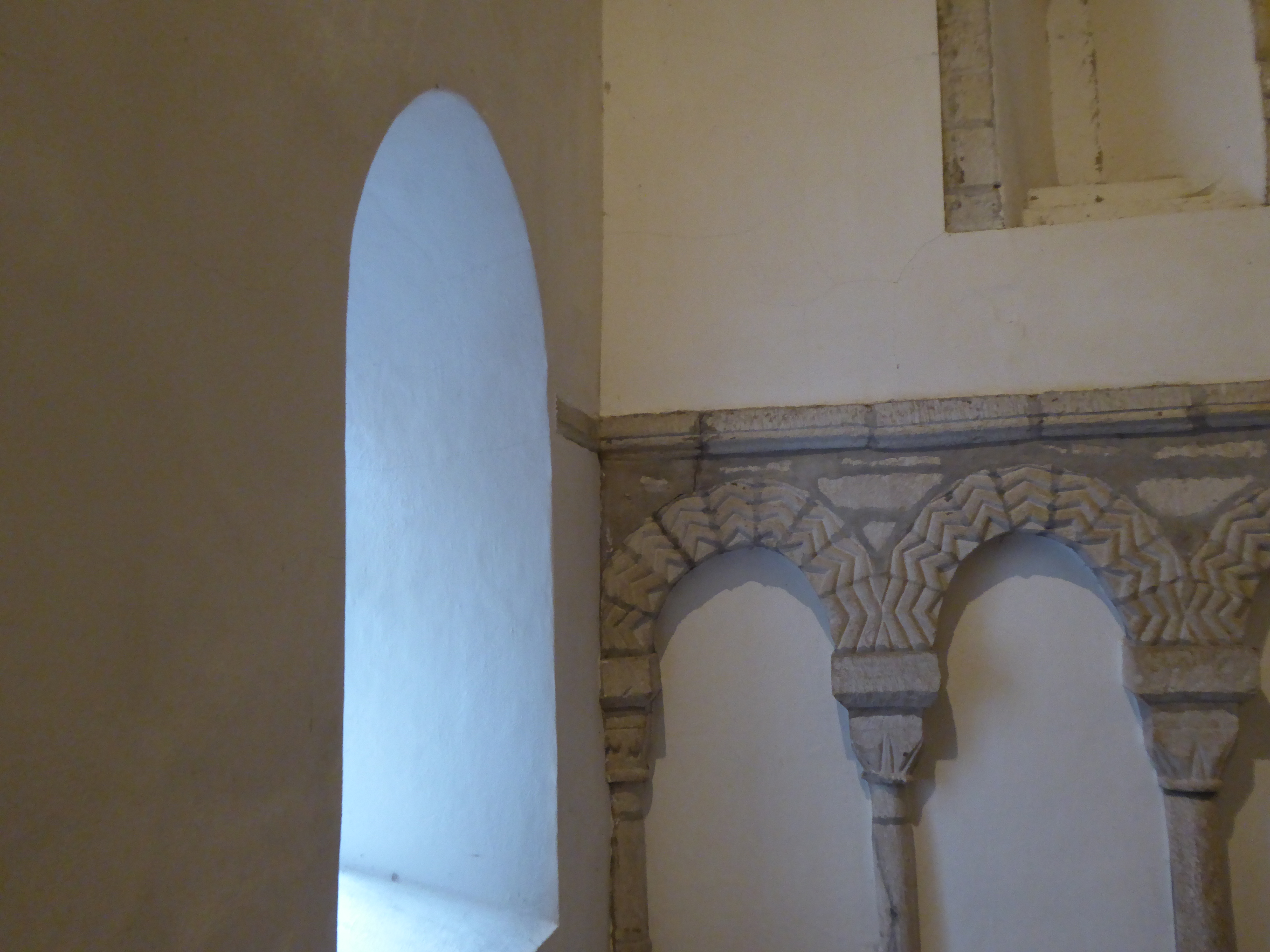
 Off the beach at last we walk on top of the flat shore wall beside the busy coast road. Then the path leaves the road and takes us up a field. Suddenly a great near-panorama open before us. Behind us we can still see Ynys Seiriol, then the Great Orme and Penmaenmawr, Penrhyn Castle and Bangor, with Dyffryn Ogwen beyond; and the cloud-covered mountains around Snowden. And immediately below us, Edward I’s concentric castle on the edge of Beaumaris. We’re only a hundred feet above sea level, but this must be one of the best viewpoints of the entire Wales Coast Path.
Leave a Reply