 10:50am. A bus stop on the coast road in Amroth. The Silcox Coaches bus, ten minutes late, trundles round the corner from the hill into the village. Its driver, a middle-aged woman whose accent doesn’t sound local, brakes reluctantly for us. Our first crime is to stand on the wrong side of the road. Which place are we aiming for, she asks wearily through the window, Pendine or Tenby? Then C, used to paperless Swansea buses, fails to take his ticket. ‘Ticket!’, roars the woman at his retreating back. The narrow road to Pendine is single track, and the bus stops for a car to pass. The car hesitates. ‘There’s plenty of room, you muppet!’, our driver snarls. It’s a short journey, but we leave the bus with relief. ‘Thank you!’, we say, in the usual Swansea way. No response from the driver’s seat.
From then the day improves. The weather’s bright without being too sunny or warm. That suits the three of us, since the path from Pendine back to Amroth, though only around five miles, is strenuous. It takes cruel delight in rewarding you, after a hundred or more steep steps up, with a sudden dip down and yet more steps up to the next point. And so on. At least there are steps to help us, though they seem to have been designed by people of more than average height and stride. Some of their treads are made of railway sleepers, which ooze black tar in the warm sun.
 First we climb up to Dolwen Point. Behind us stretches the six straight miles of Pendine Sands, a red flag prohibiting public access to the final five. The sun lights up only the far end, round Ginst Point. The clockwise-moving eye lingers on another long sandy beach, but far off in the distance – Cefn Sidan – then the dark shape of the Gower Peninsula, culminating in Worm’s Head. Thanks to the earth’s curvature the Worm looks like two separate islands. Next, the dim outline of the Devon coast. Then, much closer, Caldey Island, with a sandy beach facing us. Next, Tenby, the spire of St Mary’s Church quite clear on the horizon, and further towards us along the coast, Saundersfoot. We feel privileged to stand alone on this high point – this is another almost walkerless stretch of coast – and drink in one of the best views in south Wales.
 The first bay, Morfa Bychan, belongs to the National Trust. What greets you there is a seatless garden chair, and a large pink container full of black plastic bags. Perhaps the Trust, tired of being tasteful, is cultivating a new grunge image. This bay was one of several in the area used as practice for the Normandy landings in 1944. Across it lies a long concrete barrier shaped like a child’s wooden brick, in imitation of a German coast defence. Chunks are missing from its pocked seaward face, exposing the reinforcing metal innards. Any rehearsal in this peaceful spot could hardly have been adequate preparation for the horrors of Omaha Beach.
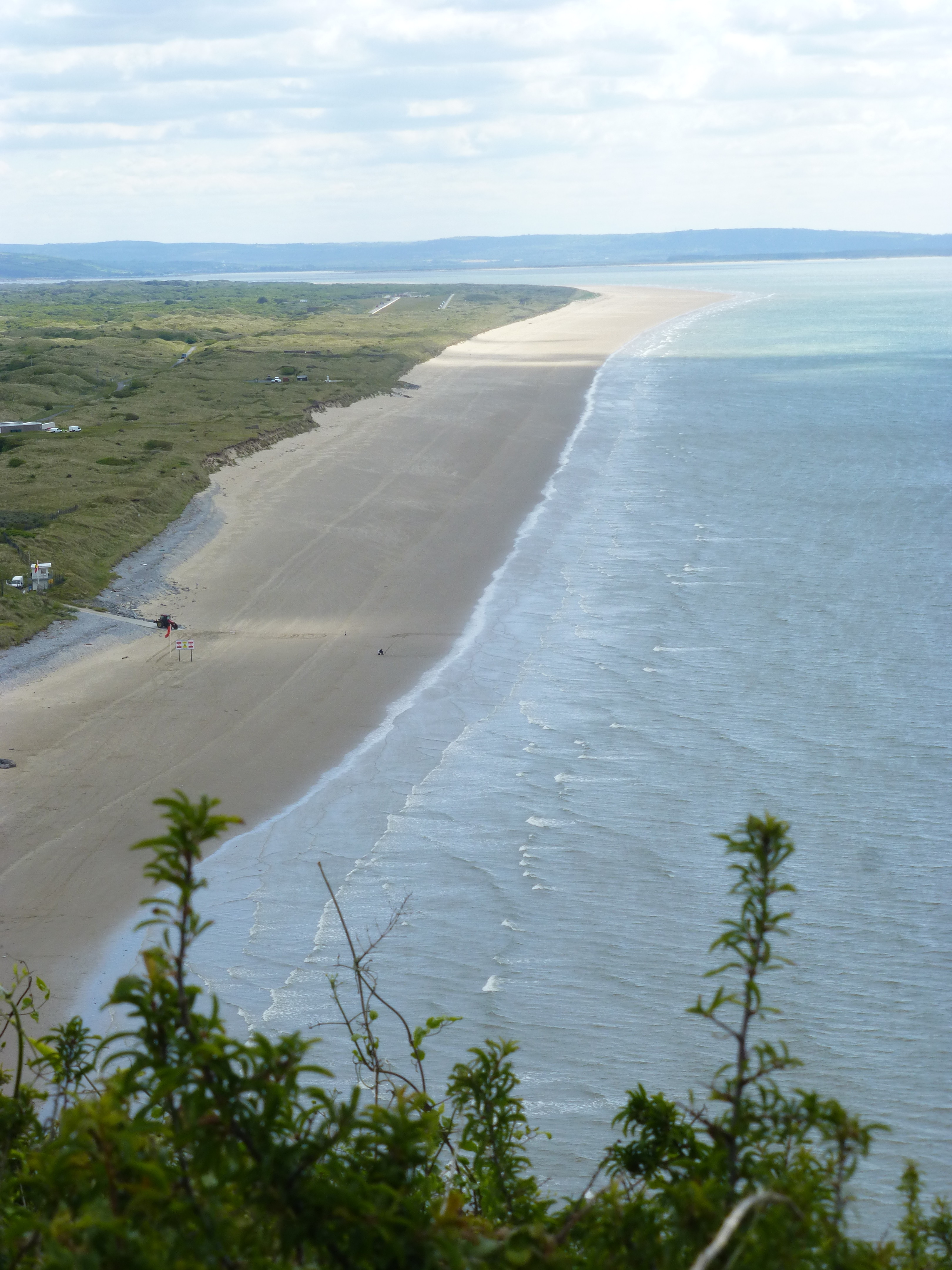
 Soon we’re in the parish of Marros. The church and sparse settlement are high up and inland, as usual in these parts, and there’s just a single farmhouse near the sea, at the end of a long zigzag lane. In between, the land shelves down in a sweet curve, like a flattened theatre auditorium. To the west is Marros beach. We’ve timed our trip badly, because at very low tide it’s possible to see the stumps of a prehistoric forest, a reminder of a once sealess landscape. Prehistoric people, from the neolithic on, were numerous here too. On Marros Mountain, above us, are the remains of three stone circles. There are also burial chambers, and a hillfort near the path, Top Castle. We traverse the slope, disappearing into unexpected woodland at one point. On the open hill bracken unfolds its new fronds – you can almost hear them stretching out into the warmth – and gorse, foxgloves, ragged robin and clover border the path. Above, crows and gulls have the high air to themselves.
 The path descends again, to Teague’s Wood, cradled in a bowl-like natural auditorium. The ghosts of dead trees interrupt the new growth. A wooden bridge across a stream marks the boundary between Carmarthenshire and Pembrokeshire, though there’s no sign, let alone passport control. It seems a while since we first set foot in Carmarthenshire, whose long estuaries have detained us like sirens over six months of intermittent walking. Near the bridge great slabs of rock glide into the sea above a grassy bank. It’s an ideal spot for a picnic, but there are more hills to climb and our food supplies are already spent.
Each hill we greet as the ‘last climb’, only to find yet another ahead, but at last the long wooden groynes of Amroth beach and the caravans of mock-Norman Amroth Castle appear below us. The JCB and tractor we saw rearranging the stones on the beach by the bus stop earlier have moved eastwards and are having a break from their unceasing labours against the waves. A stone and plaque, a mile or more out of position, record the end of the 186-mile Pembrokeshire Coast Path, opened by Wynford Vaughan Thomas in 1970.
 Our guide Mr Moss, who has some curious bugbears, doesn’t seem to like Amroth: he calls it a ‘poor cousin to nearby Tenby and Saundersfoot’. But it’s a tidy and pleasant village, and aware of its history. The inhabitants have put up some well-written information panels that urge us to wish away the prettiness of the modern village and recall the lost industrial village of the nineteenth century, busy with coal extraction and iron working and export shipping. We have a late lunch in the sun outside the New Inn and watch as a group of gentle bikers finish their meal and nose their machines quietly into the narrow lanes. We’ll be back to ‘finish off’ Pembrokeshire in the autumn.
Leave a Reply