
I’m awake before 4:30 this morning, after a nightmare in which I’m on the run from armed police and have to hide in the branches of a tree. The meaning’s obscure, but the presence of trees is easy enough to explain. So far the Wye Valley Walk has spent most of its time surrounded by them. There’ll be more today.
It’s a cool, very still morning, with mist hanging over the river downstream. I get up and explore the steep path that leads from near the hotel to Yat Rock, but decide it’s too far to reach the Rock before breakfast. After breakfast we set out and go wrong almost immediately, missing one path and failing to find the right opening into the wood on our right. Minor failures of navigation happen a lot on this trip, even using a combination of guidebook, Ordnance Survey app and signposts and roundels. The guidebook is often imprecise and the signposting hard to spot (the Wye Valley Path logo is poorly designed and difficult to see from any distance).

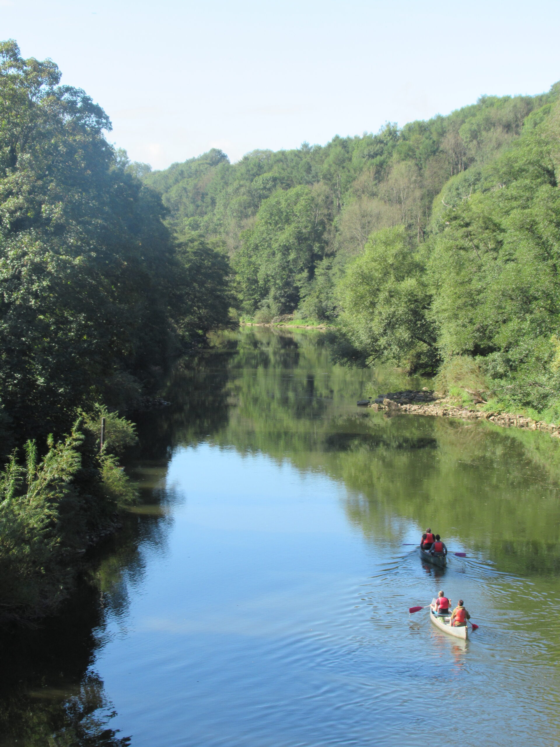
The woodland path mirrors the river, at a distance, as it loops round in a near-circle. We join a track and go wrong again, discouraged from following the correct path by a naughty ‘private property’ sign. But we press on, joining the old railway track after its emergence from a tunnel, and find ourselves near the river again. Again, it looks dark, sullen and lifeless.

Suddenly we emerge from the trees into an open, landscaped landscape, dotted with a few ancient trees. It’s not hard to imagine late eighteenth-century picturesque tourists halting their boats here and mooring them to the river bank, before taking out their picnic baskets and sketchpads. We’re still on the railway track – what a wonderful trip this must have been, before Beeching stopped the trains! – but we stay on it too long, and have to do a bit of trespassing to regain the path, now on the river bank.
Ahead of us, at Lydbrook, is something incongruous in this wholly rural setting: the remains of a large factory, with tall chimney. The guidebook tells us that in this cable works over 650 people once produced almost all the wire used for communications in the trenches of the Western Front during the First World War. In the Second World War, as the Edison Swan Electric Company, it made the wire that heated the jackets of Allied airmen. The plant, now producing paper packaging, closed around 2003 and now stands derelict. Photos of the rotting interior show how opulent were the offices for its managers. Both wire and paper connect with much earlier industries in the middle Wye valley.

Before long, we reach Welsh Bicknor, Llangystennin Garth Brenni in Welsh (this area was once part of Wales). Here there’s a second surprise: a peach of a neo-Gothic church. It stands in isolation just above the river and shines as if it had been built yesterday. An earlier medieval church once stood here, but few traces of it survive. Effectively the church was rebuilt, brilliantly, in 1858 by the obscure architect T.H. Rushforth, under the direction of the wealthy rector, Stephen Allaway. Inside, Rushforth lavished attention on every crisp but economical detail: the font with its alternating head and foliage frieze, bold stained glass (‘Duw a digon’, says one), organ pipes in mauve-and-silver, semi-precious stones inlaid in surfaces. The sandstone tower, strong but graceful, tapers to a broach spire. There’s a striking lychgate and a tall cross. The church was been restored recently, and the grounds are beautifully kept.

As we admire the church, a pair of walkers appear and ask us the way to Goodrich. It’s tempting to reply, ‘I wouldn’t start from here, if I were you’. As the crow flies the village is close, but getting there on foot is complicated.
Our next target is Kern Bridge, via a long bend in the river. The first part of this stretch is easy enough. To our right is steep woodland, Thomas Wood. Cows in the field to our left are called loudly – Herefordshire cows seem bigger and louder than most – to other cows lost up in the wood, and two women race past us on a quad to rescue them. In the last couple of miles, however, we have to tread through waves of head-high Indian Balsam and vicious early autumn nettles. C, as usual, is wearing short trousers and suffers injuries from the nettles. Indian Balsam is usually described as ‘invasive’, but on this part of the Wye it’s ubiquitous and rampant.

As we approach the bridge Goodrich Castle comes into view across a ploughed field and up a gentle slope, but we turn in the other direction and cross the bridge. And there before us, as if by divine intervention, is a pub, the Inn on the Wye, and, even better, it’s open. Refreshed, we move north, up and down a path to avoid a road, and then cross two hills, Bull Hill and Howle Hill. Along the way we pass a small vineyard with full purple grapes. After we make a wrong turn in a wood, a man shouts gruffly that we’re on his land and must retreat up the hill. He has a full beard and is wielding a large hammer, so we think it wise to obey and walk round his estate. We curse him silently as we leave.
At Coughton another wooded hill, Chase Wood, faces us. M. thinks better of tackling it – the guidebook gives it a large up red arrow – and takes to the road. The rest of us march on. A large field with an unidentified crop gives way to woods. The gradient suddenly worsens, and we need several stops to regain breath before, sweat dripping off us, we reach the large prehistoric hillfort on the top. After one more wood, Merrivale, we can see Ross-on-Wye below us, and the rest is downhill, then through the suburbs of Ross. Soon we’re sipping drinks on the terrace of the Royal Hotel, as the sky turns red. Tomorrow promises to be fine.


Leave a Reply