 We’ve stayed in cottages, houses and old chapels in previous walking weeks, but never in a penthouse. But here we are, in The Penthouse, in a building that’s part of the sea front at Pwllheli. It’s a replacement for the old West End Hotel, built by Solomon Andrews, the original developer of the grand seafront terrace. The terrace stands at some distance from the town, à la Cardiff – there’s even a mini-Bute Street, running in a straight line from centre to sea. The whole area’s seen better days – a long time ago. The recent architecture’s drab and cheap, and the few remaining shops have closed. But from the top of The Penthouse this doesn’t matter. You can’t see its exterior, only sweeping views through its windows towards the mountains of Snowdonia, down the coast to the south, and west along to Llanbedrog, Abersoch and beyond.
Yesterday’s gloomy weather’s been swept away. It’s a sparkling morning, no clouds in the sky, and the tide’s high. On the shingle at the sea’s edge the first fisherman has set up. He’s placed a second seat on the other side of his rod, as if there’s a companion to share his thoughts. Before long other fishermen have arrived. There’s clearly a standard regulation distance between their pitches.
 An hour later we’re in Aberdaron, to continue where we left off our walk last year. C, H and I are joined by two friends of C and H from Wolverhampton, A1 and A2. Over coffee A1 show us her ingenious but painful tool for extracting tics from the skin. It looks as if it might have been useful to imperial adventurers in the nineteenth century. I feel glad that, unlike C, I never wear short trousers for coastal walking in long grass. A1 and A2 are seasoned and serious ramblers, the first such to join us as guestwalkers. Their backpacks are sophisticated, framed jobs. They have the best walking sticks, carry a full medical kit and pharmacopeia, and their smartphone has an app that records location, distance and speed. Alarmingly, they announce from time to time that our average speed has dropped again, say to 1.2 mph. You sense that this is less than acceptable in normal circumstances. But they’re very understanding, and they don’t stride off in front of us slower mortals.
At the west end of the beach the path climbs steeply to gain the cliff top, an introduction to the more serious climbs to come later in the day. Then it falls again to Porth Meudy. No hermits are available here today, just a few German tourists waiting for the fast boat to Ynys Enlli. The island and its 20,000 buried saints awaits them, unseen, round the corner. We press on, climb again, and pass three more coves far below, Porth Cloch, Porth y Pistyll and Hen Borth. Porth y Pistyll has the stone ruins of an old harbour, a reminder of the days when the sea was less empty than it is today. Even on a perfect summer’s day like today we see very few yachts on the ocean, let alone more serious shipping.
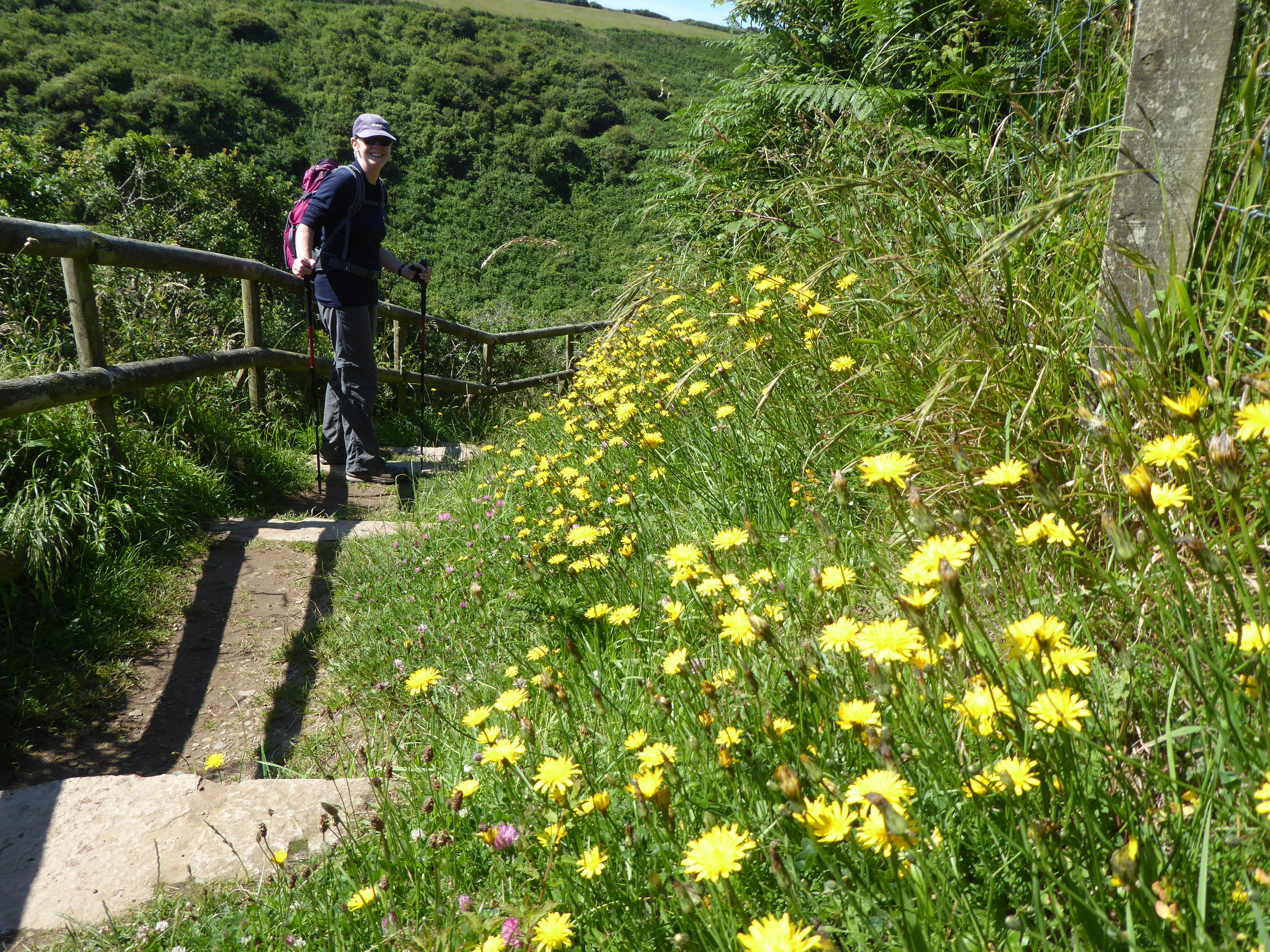
 All along this sheltered coast flowers soak up the sun: foxgloves, wild thyme, violets, clover and above all yellow hawkweed, clouds of which cover the cliff banks. H spots a slow-worm on the path and shouts to us not to step on him. True to form, he makes a few languid turns but no effort to move to safety; the sun on his back is too inviting.
Now we’re at Pen y Cil, the southern tip of Pen Llŷn. Ynys Enlli comes into view – just the steep hilly half for now – across the tidal races of water in between. On such a placid day it’s hard to imagine how in the past the island might have been cut off for days on end when the weather was stormy and boats less powerful. As we move north-eastwards it begins to change shape. The low parabola of the northern, low-lying part comes into view, and the tear-drop forms. The lighthouse and a few building take shape.
 Now the terrain changes. Big cliffs appear, like the straight vertical slab of Pen y Gwyddel jutting into the sea in front of us. The path prepares to take on Mynydd Mawr, not huge or a mountain, but a serious effort when all we’ve been used to lately is the flatlands of the north-east coast. We reward ourselves for the climb with sandwiches and samosas, sitting on the leeward side of an outcrop over the sea. Sheep feed below us, and three buzzards circle overhead. The shadows of ravens (maybe some choughs too?) move silently over the short grass. A sinister, well-groomed gull positions itself on a rock a few feet away, ready to swoop on our food droppings. Being tidy people we’re likely to disappoint him.
 The climbing starts again, towards an old coastguard lookout near the summit. Just below are the concrete platforms of a Second World War emplacement. From the summit of Mynydd Mawr a wide view opens across central Llŷn, towards the triple peaks of Yr Eifl, and beyond to Snowdonia. Then a gradual descent to the coast. In one valley, operatic cows seem to pose on a stage, in a field out of sight above us. We pass an isolated whitewashed cottage, its age betrayed by its big squat chimney, hiding from the westerly weather. In front, an old wall, built with stones on their edges but capped with broad flatstones and a flowered topping. Then, suddenly, after miles of bare rocky coast, a sheltered white beach appears: Porthor (Porth Oer), in English, Whispering Sands. The path, though, stubbornly fails to join it, instead moving inland to the car park, where car no. 2 is waiting for us. We leave off exploring Porthor till tomorrow.
Leave a Reply