Another sunny morning. We pick up some sandwiches from Hopes, Longtown’s village shop. This must surely be the best village shop in the UK. It’s like a mini department store, and stocks almost everything you’d ever want; it even has micro-bookshop, and it acts as a post office, with a sorting office in a metal container at the back. It prides itself on sourcing locally, and we find we’ve bought sparkling water from the Black Mountain Mineral Water Company of Longtown. Among the newspapers is the Hereford Times. Its front page tells us, ‘DIY baby is born in B&Q car park’.

We’ve taken the precaution of asking in the Crown Inn about the path to take to the mountain. At first all goes well. We cross the river and negotiate the barns of Cayo Farm. But a rogue sign has us clambering over a rickety fence, with great difficulty, only to find no way out of the next field. The final footpath score (Longtown League) is: Herefordshire farmers 2, Ramblers 0. We’ve lost our way so many times on this trip that we’re starting to doubt not just our spatial awareness but our whole mental equipment.

At last we clamber out of the barbed wire-armoured fields on to yesterday’s track, and re-find the grassy path up Mynydd y Gader. It’s a steady climb; as long as we take enough breaks for breath it’s not difficult. An hour and a half after starting, we’re back on the top, and on the Path. It takes us north for several miles, with huge views over the English borders as far as the Malvern Hills, though today there’s a blue haze in the air and visibility is poor. At first there are skylarks, high above the whinberries and heather, but as the Path steadily rises hill turns to mountain, heather alternates with whitened dead grasses, the skylarks disappear, and the ground becomes boggier. The Path has been superbly engineered here, with raised grit walkways and stone flags in specially wet areas. We make swift progress, passing trig points and stones inscribed with directions to points off the mountain. One stone has fallen over since we left the hill yesterday, and we try to right it and wedge it with smaller stones. It’s easy to believe, as all we can see ahead is the slight dome of the horizon, and wild land between, that we’re nearing the top of the world.

As mile follows mile we resort to mental games. We’ve played the ‘App Game’ before: thinking up unlikely new apps for smartphones. Our favourite is a Shazam-for-birdsong: a gizmo that will tell you instantly, when it’s fed birdsong heard while out walking, which bird is responsible. We’ve been talking about holidays, and this time we come up with an app that, if you enter the name of a resort you’d hate to go to, like Cleethorpes or Torremolinos, would recommend a top-class alternative within 50 miles. If only we were entrepreneurial by nature, we’d be millionaires by now.

A breeze blows up at our backs. To our right the Black Hill starts its parallel march north, enclosing the mysterious head of the Olchon valley, the setting for Owen Sheers’s novel about Nazi occupation, Resistance. On the left, the Vale of Ewyas is out of sight, but the steep valley side opposite shows a series of strange circles, which we’re unable to explain without resort to extraterrestrials. Few other people are up here. Three men have climbed up from Llanthony Priory – we soon leave them far behind – and a group of twelve of so walkers are ahead of us. Otherwise we’re alone with the sheep and the wild ponies and their young foals, maybe descendants of the ponies David Jones painted when he stayed at Capel-y-ffin below us. Before the head of Hay Bluff the Path swerves off right and tracks round the east side of the hill. A strong wind funnels up the valley behind, and we try to find shelter behind a boulder to eat our sandwiches. Further north, near the car park and road, the landscape changes: you almost expect golf buggies to appear, so cropped and neat is the grass.

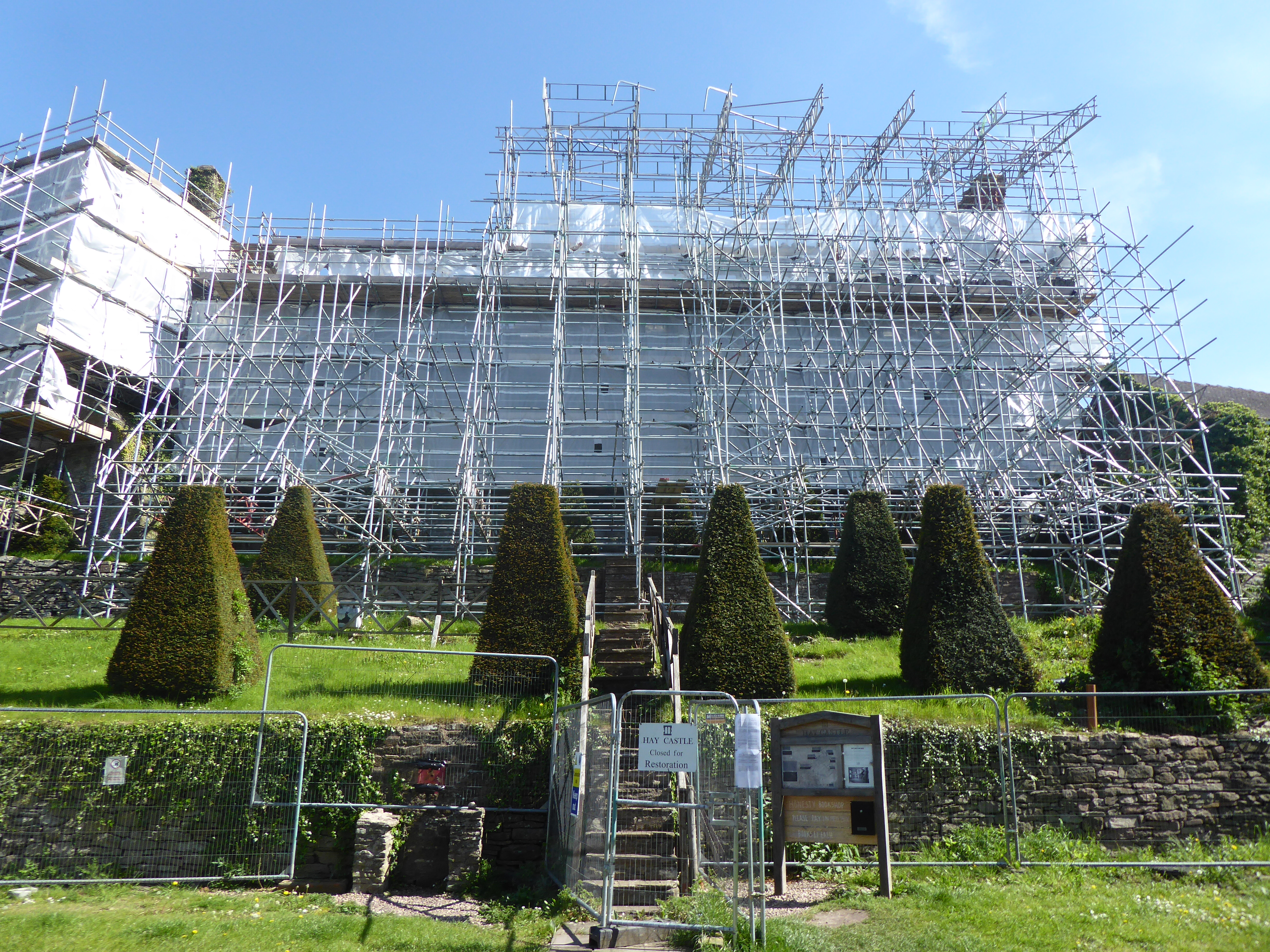
The long descent to Hay – it takes almost an hour and a half – has everything: smooth grassy slopes, woodland walks, tarmac lanes, narrow ginnels and a buttercup meadow at the end. The National Park has recently installed new ‘path furniture’ – gates and signs – including many ‘Pembrokeshire hats’ – yellow plastic caps fitted to the tops of posts that can be seen easily from a distance. The very final gate is so sophisticated it has us, gate experts by now, mystified. Later we have a preview of the Wye from the town bridge. The river bears little resemblance to the river we saw two days earlier. Children with wetsuits and helmets are splashing in the unusually low waters. Then we wander through the bookshops and the town – the castle, under restoration, is completely sheathed, like a Christo sculpture – before a meal in the Blue Boar.


Leave a Reply