I’ve not slept well in Beddgelert. The reason, I think, is that our B&B is beside Afon Glaslyn, and I’m not used to sleeping with the constant noise of running water. Today we’re going to be following the river downstream towards Nantmor, before turning to Croesor and beyond. Yesterday’s heavy rain has begun to turn the river into a livelier steam than when we arrived: its dabbling ducks have vanished. At least the weather has improved from yesterday, though rain is predicted later.
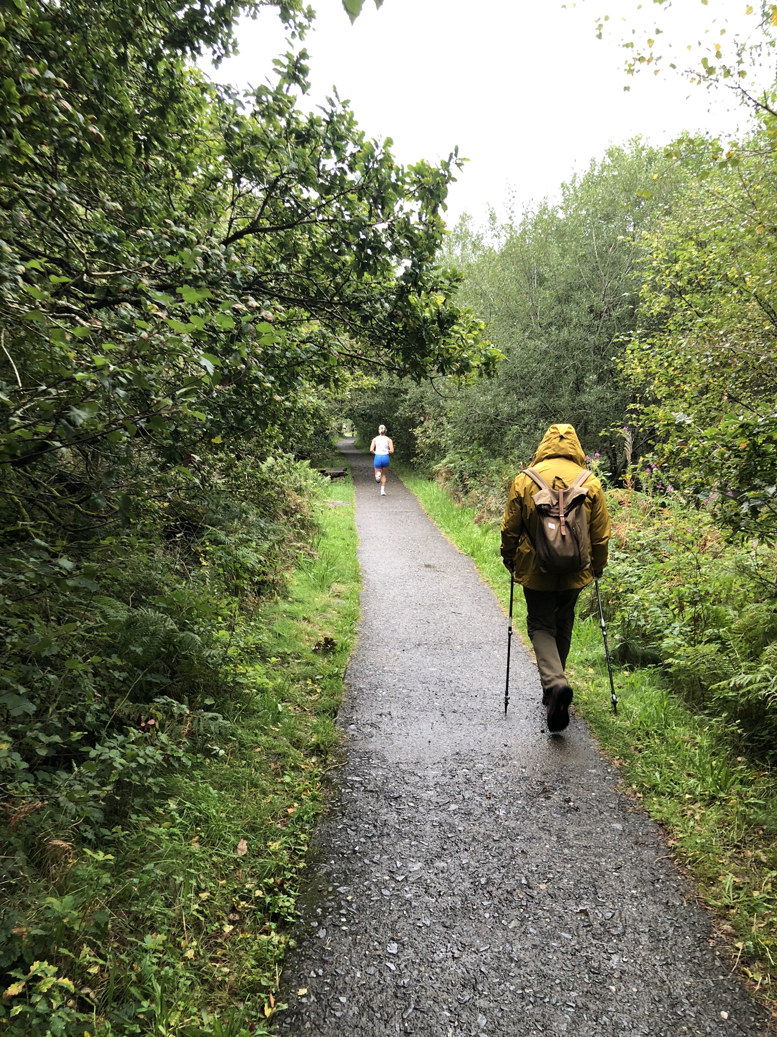
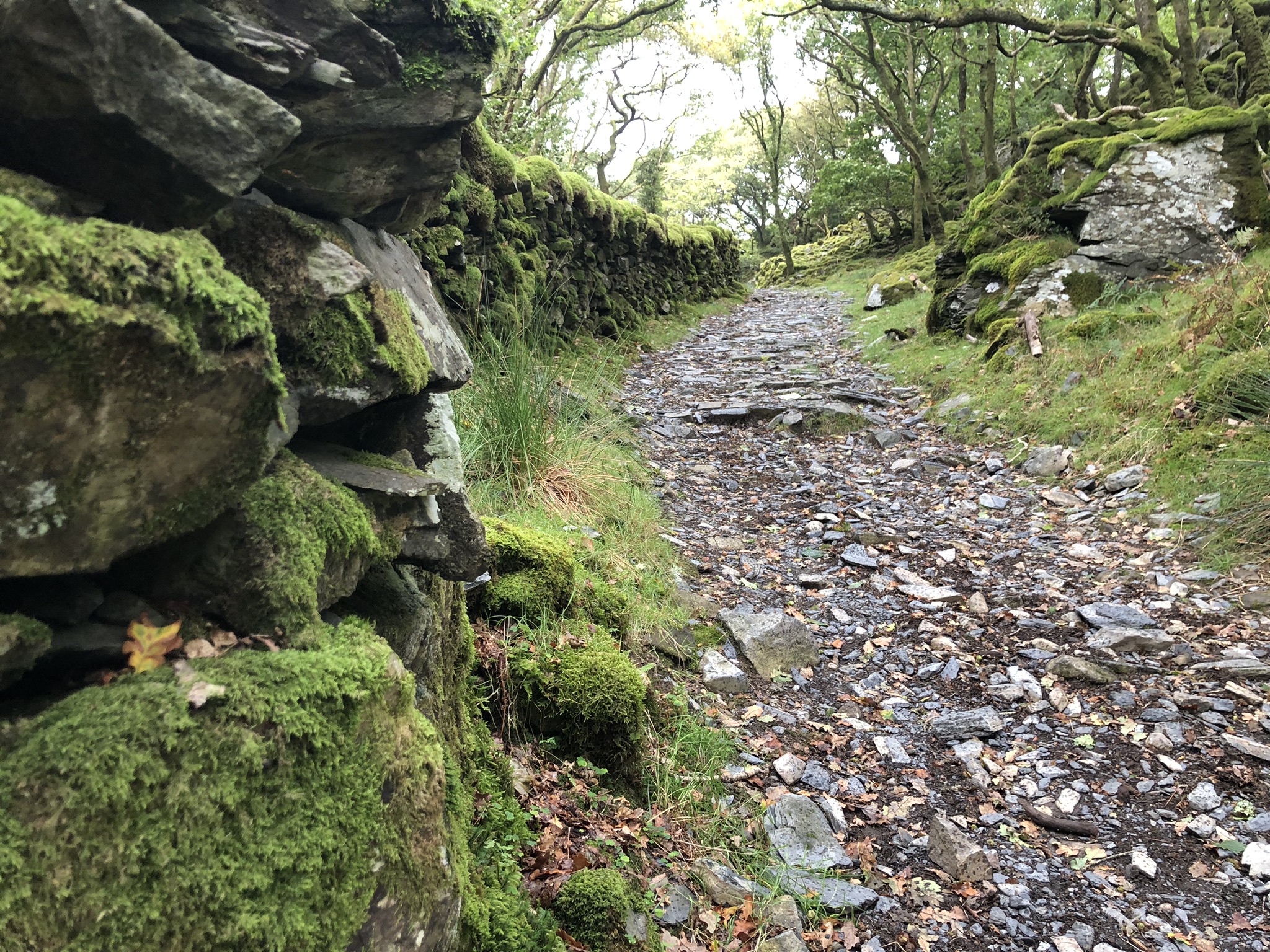
The start of the walk is tame, along a broad concrete track. We’re following the route of the Highland Railway, and soon we cross the track, at a sign that boasts ‘Electric trains here? No, steam!’ We debate the ecological doubtfulness of this, before carrying on down what soon becomes a steep, wooded gorge.
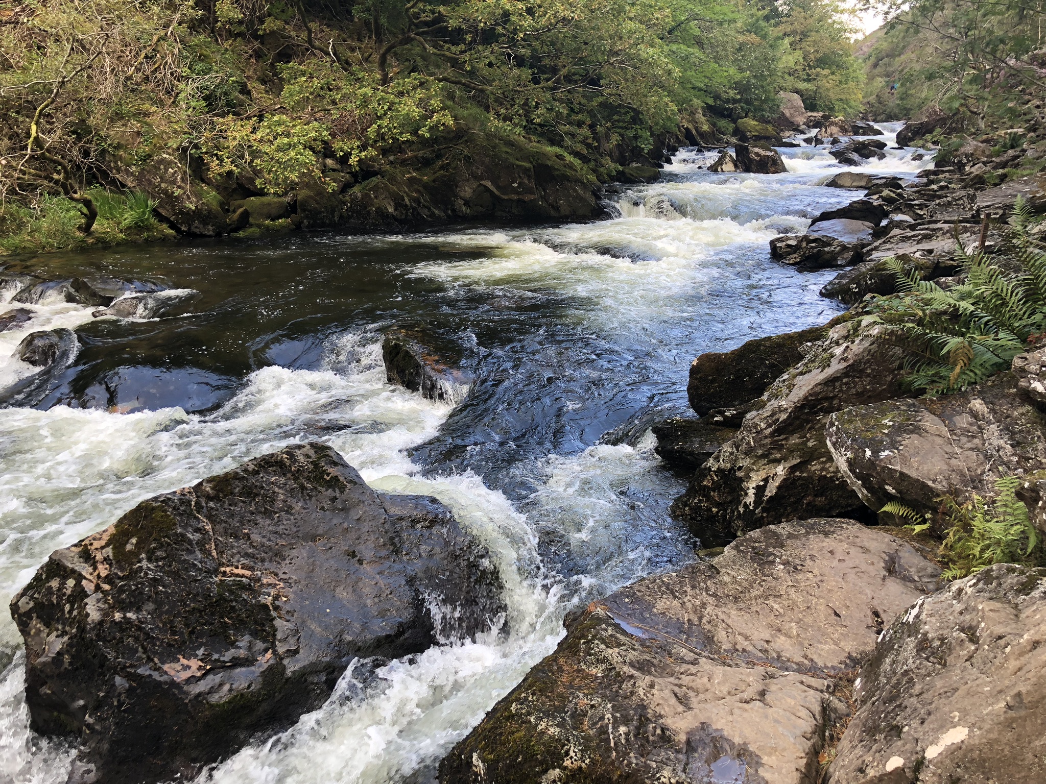
Aberglaslyn Pass was already a honeypot for eighteenth-century tourists in Wales – perhaps it gave them the sensation of hiking through an Alpine valley in miniature – and, for the first and only time on this trip, we’re amongst plenty of contemporary tourists, out for a Sunday morning riverside stroll. Some of them aren’t well shod or clad for the terrain. The path’s rocky, uneven and slippery, and mostly keeps very close to the rapidly moving water (when the Glaslyn’s in flood, the route is impassible). There’s no denying the attraction of the scenery, though.
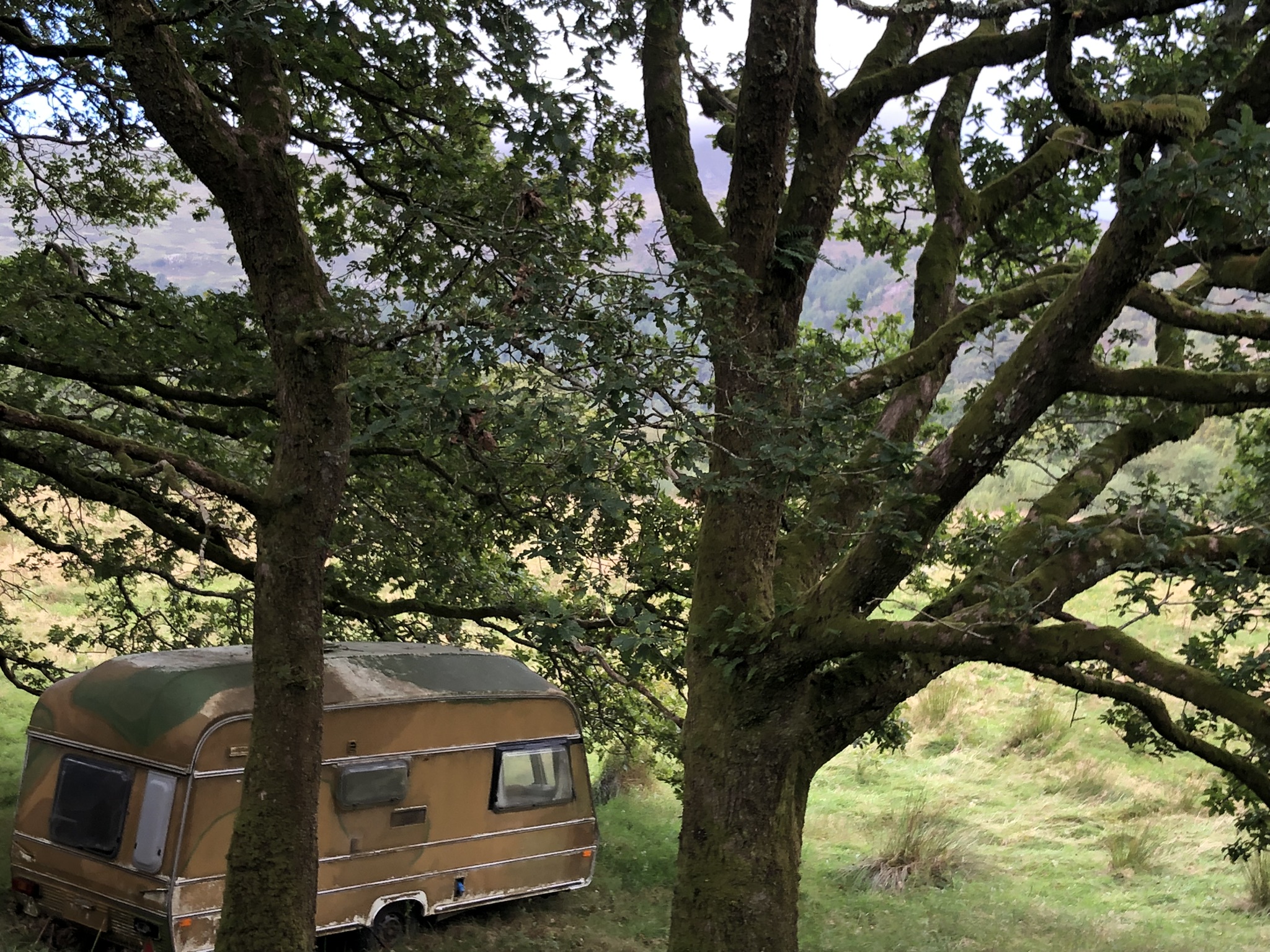
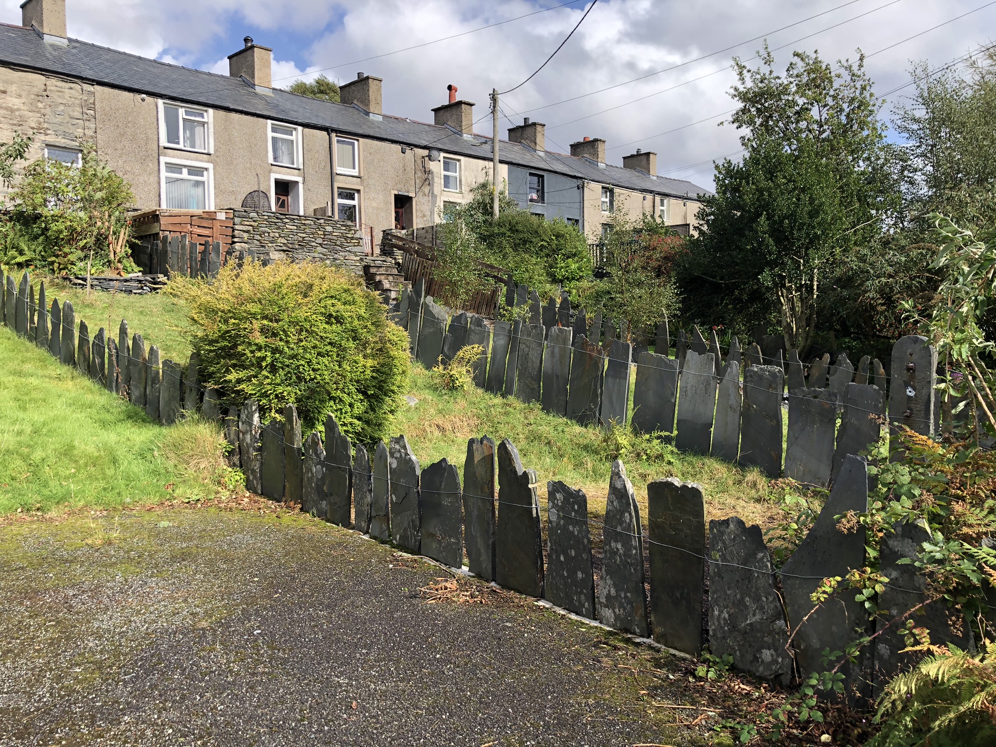
The path turns away from the river at Nantmor and takes a lane that leads through the village and beyond, up a quiet wooded lane. Among some trees on the left is an old caravan, painted a pastoral shade and slowly melting into the landscape so that it’s barely noticeable.
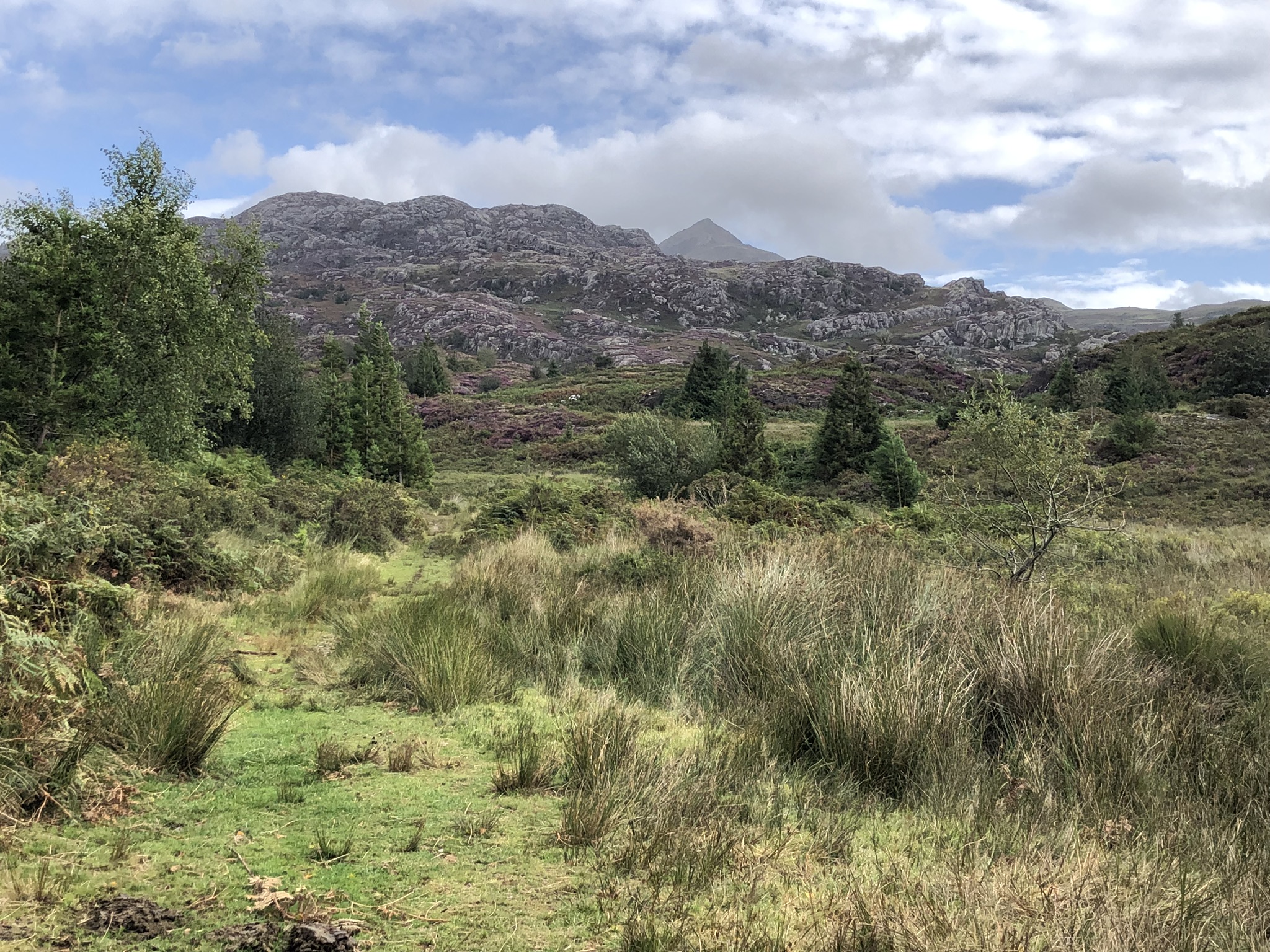
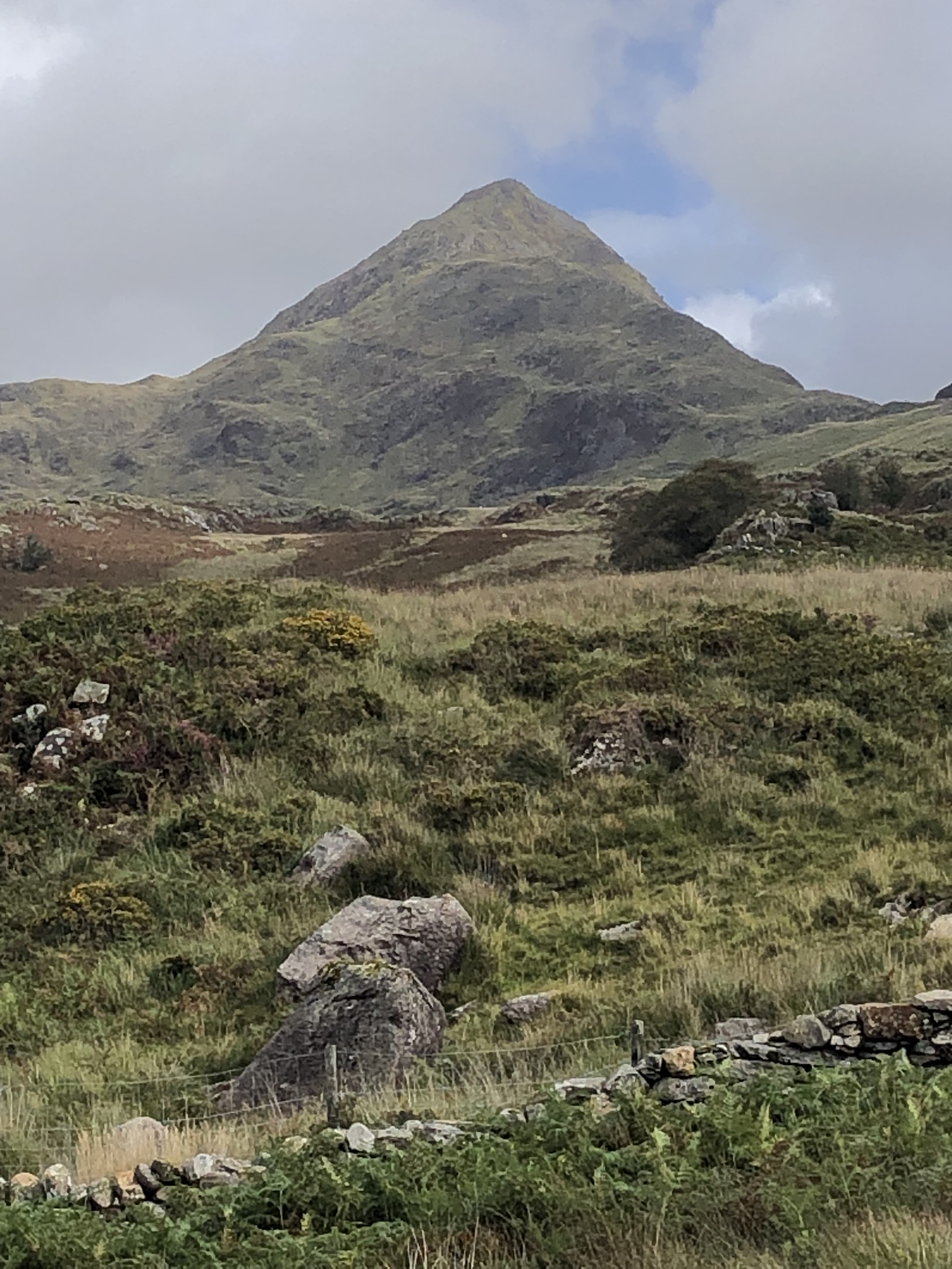
At an old cottage at Bwlchgwernog, we leave the road behind. The path climbs gradually, beyond the treeline, into open country, with good views to rocky outcrops on our left. We stop here to admire the view ahead and have a bite to eat. Heather’s abundant around us, and it’s in full flower, so that the whole landscape seems like a painting. Somehow, heather has colonised what look like unpromising high ledges, making the rocky hills come alive with colour. We feel our spirits rise as we stride forward through this dreamy place. To add to the picture, the peak of Cnicht starts to grow in size in the distance. From this angle you’d be forgiven for thinking that it deserves its nickname of the ‘Welsh Matterhorn’.
As we get further on, though, the going isn’t all easy. We notice that someone has placed a warning on the online OS map, and sure enough we find ourselves manoeuvring tentatively and awkwardly through several boggy stretches and some deep pools. This puts C2 in mind of his philosophy teachers, who would talk about having to do much ‘heavy lifting’. His reaction to this was that they wouldn’t know what ‘heavy lifting’ really was, since they seldom looked capable of manual work or indeed of any physical effort.
Finally, we join the stony track people use to climb Cnicht, and descend towards the village of Croesor. It starts to rain, and again we struggle to get into leggings. We know there’s a café here, and there are adverts posted for it, but we can’t find it. After scratching our heads for a while we come across it, hidden at the end of a car park at the end of the village, and find shelter from the rain. More than that, we enjoy another excellent, unexpectedly good coffee, and have a long conversation with the owner. She’s an incomer, from Cornwall. She’s restored the café building, which also includes an art gallery, and she’s very active and enterprising in efforts to support and improve the local community and sustain the Welsh language. The key to success, she says, is making sure that there are enough houses within the financial reach of local people. Luckily, the Brondanw estate, run as a charitable trust by Ymddiriedolaeth Clough Williams-Ellis, aims to do exactly that.
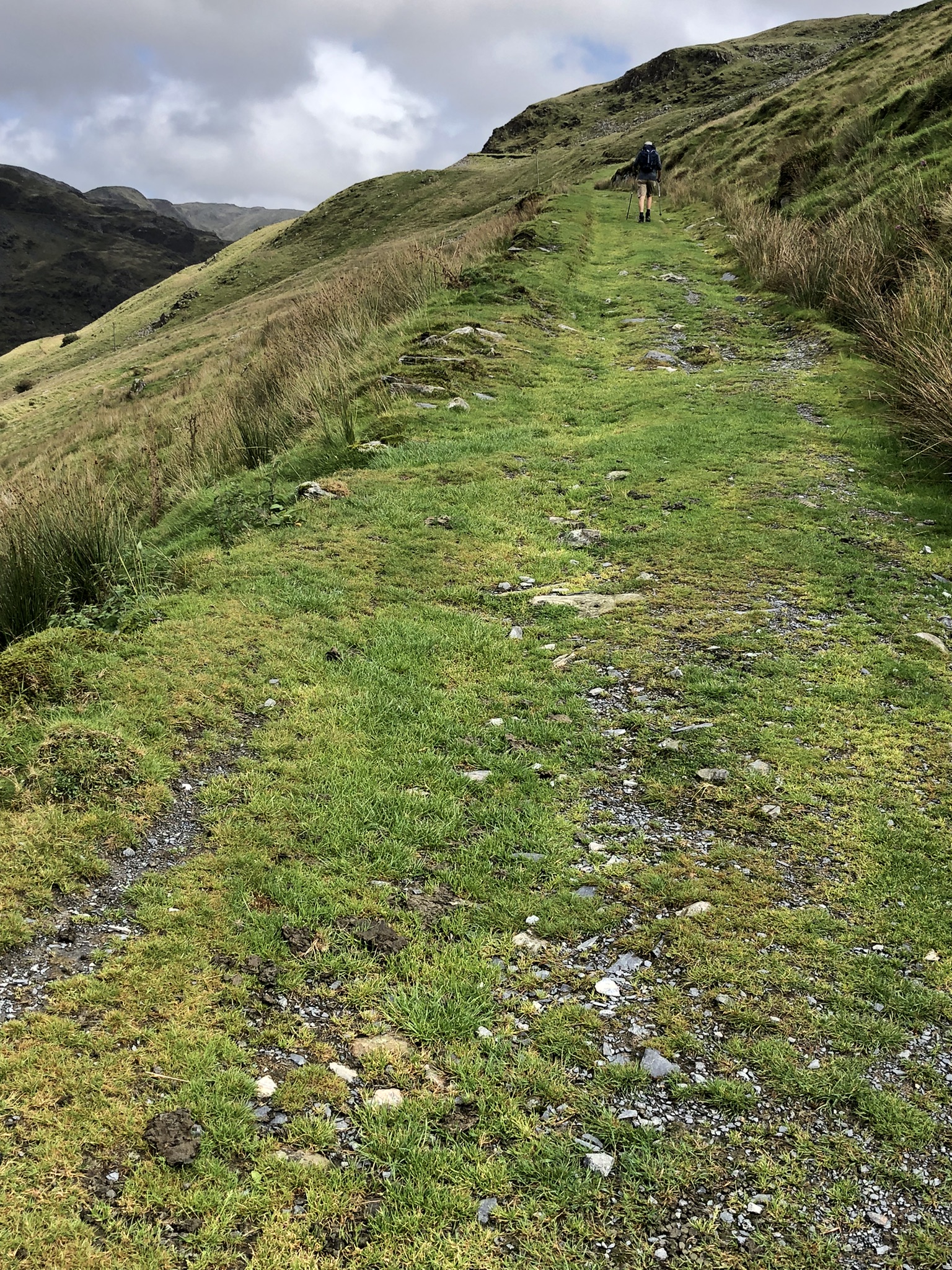
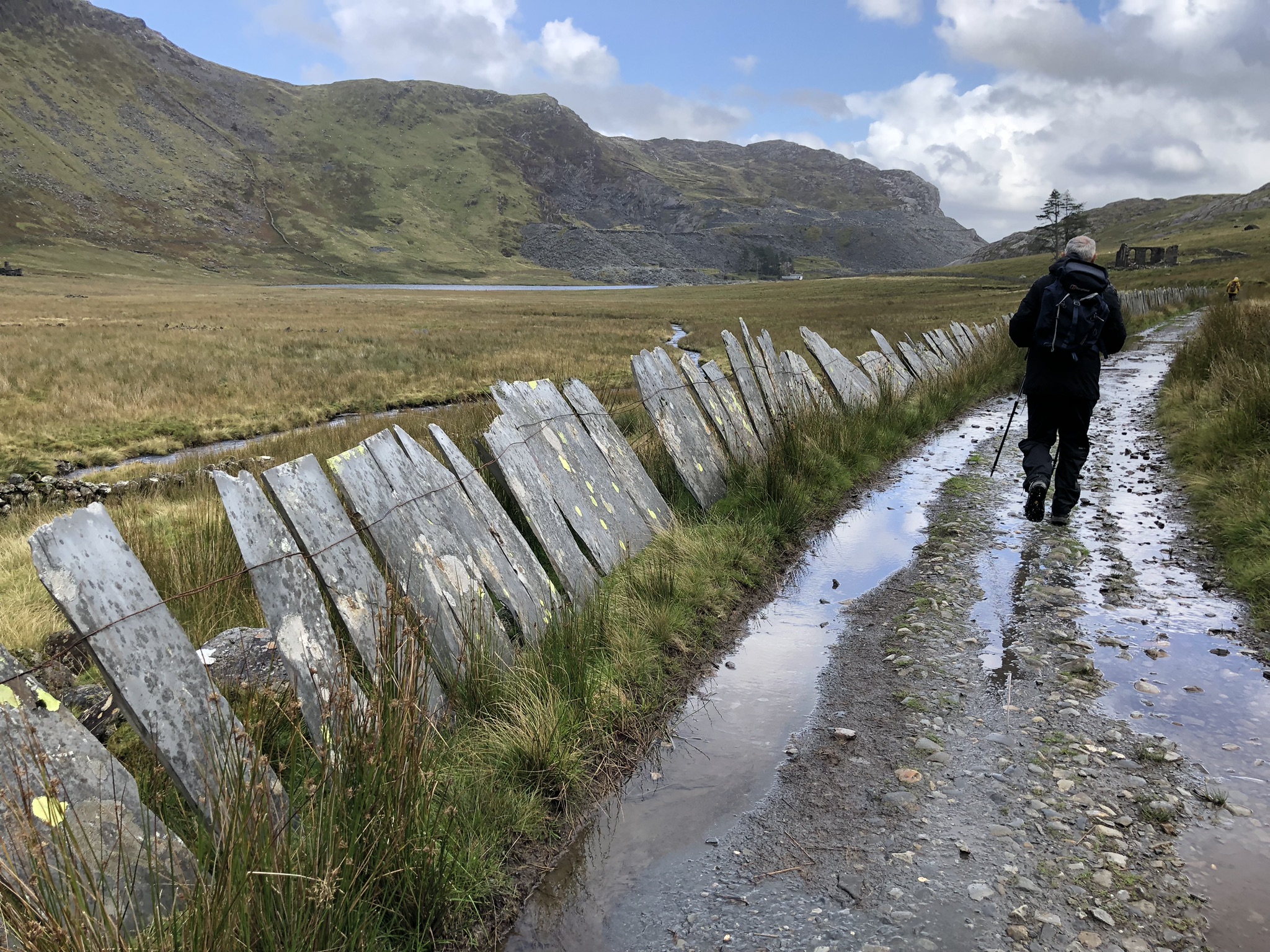
We say goodbye to Caffi Croesor and make for the track leading to the quarry. This is a grass-covered incline that keeps to a steady gradient, so it’s a painless way of gaining a lot of height by the time we reach the head of the valley. At the valley bottom and on the other side we can see various other tracks, and the hydroelectric power station that originally provided electricity for the mine drills, lighting and locomotion. Moses Kellow, the manager of the largely underground quarry, was a pioneer in slate quarry technology; his star invention was a hydraulic drill that revolutionised slate extraction.
We can see rain approaching from the south-west, so we stop before the top to eat a hasty lunch. Then on to the top of the slope. There’s a flat space here, the centre of the quarry operations. Parts of some of the buildings still survive, including one at the top of the huge waste tip that slides down the mountain: it looks like some small Greek temple.
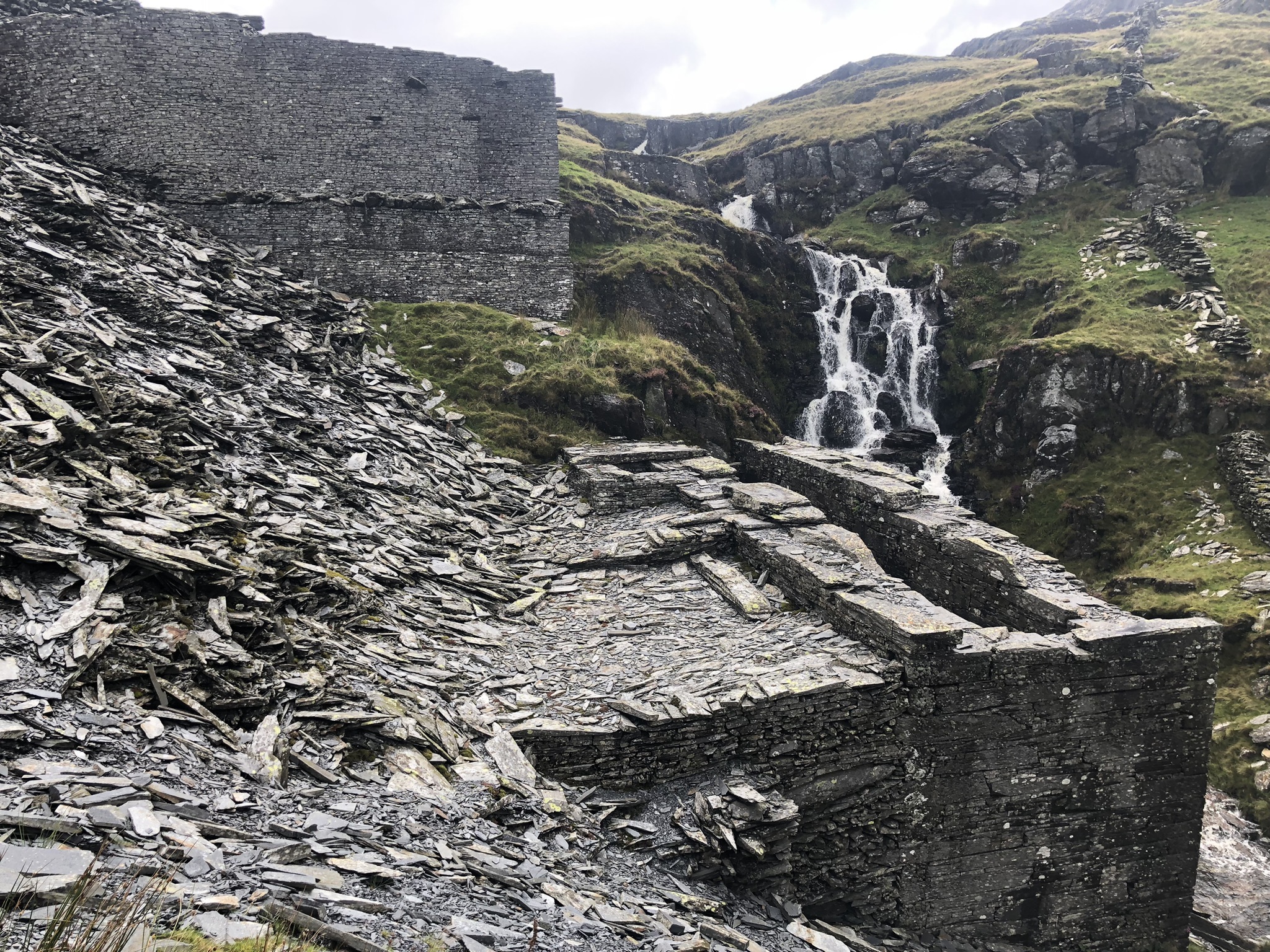
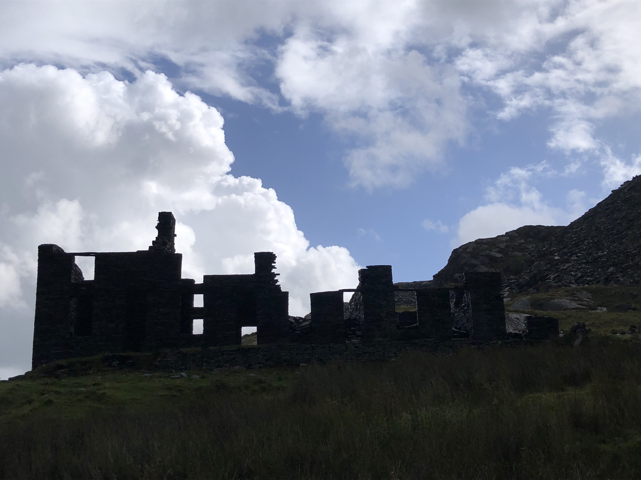
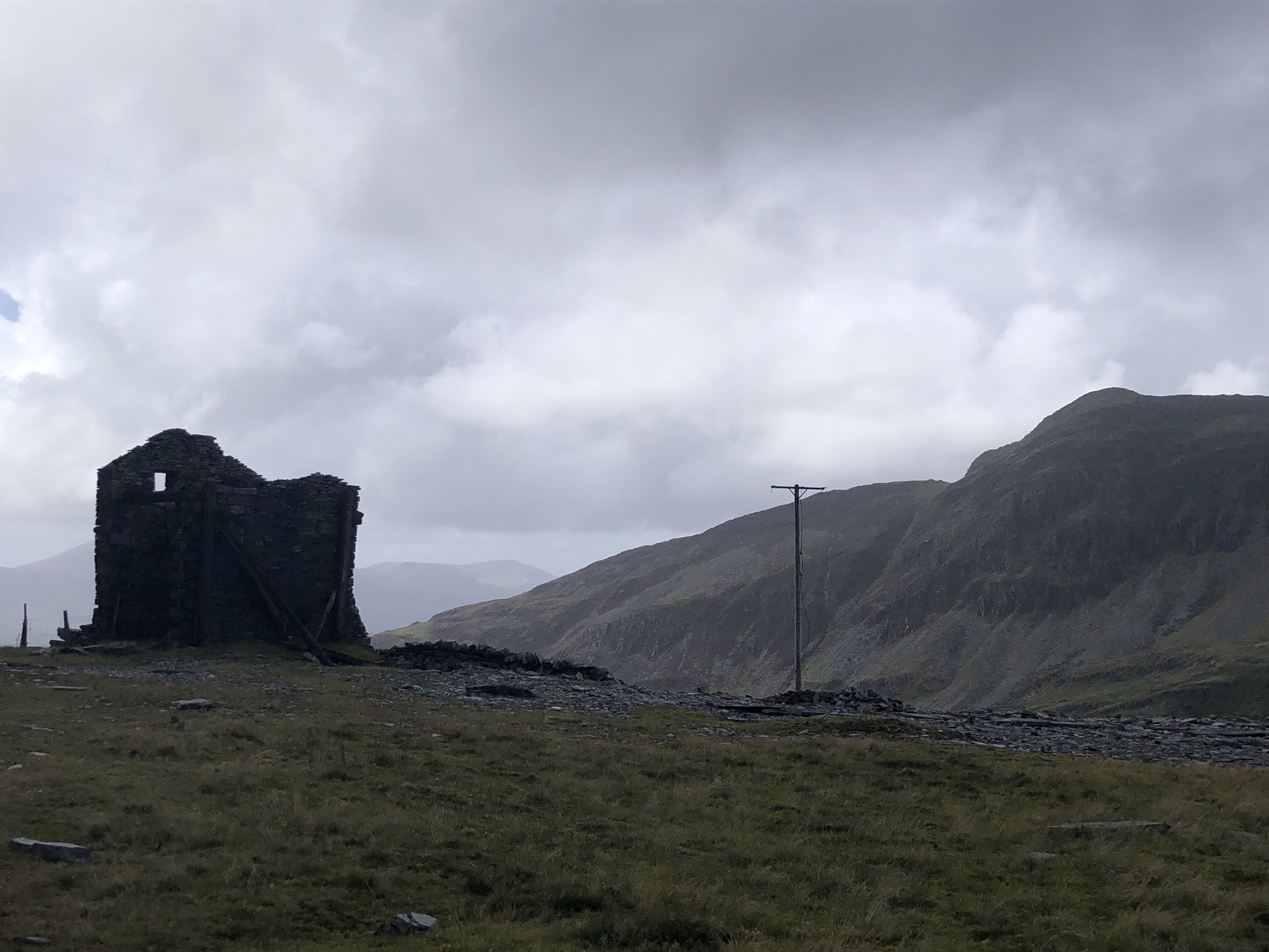
Next, an indistinct path climbs above the quarry into wilder country. Gusty wind lashes rain into our faces as we struggle up the slope. At the top, the highest point in the whole Slate Trail, a new view opens up, descending gradually to the north-east past Llyn Croesor. We cross the lake’s dam and boggy land beyond, until an astonishing sight meets our eyes. This is Rhosydd Quarry, a huge, flat expanse of abandoned buildings, including barracks, and slate waste scattered randomly about. This really is Slate City, 500 metres above sea level in the remotest of places. As the path descends from the site we pass a tall, smooth-faced slate tower and a waterwheel pit; a torrent cascades from the mountainside towards it. If we were in the Middle East you might assume you were in Persepolis, faced with the architectural scale of the site, not on a cold mountain in Eryri.
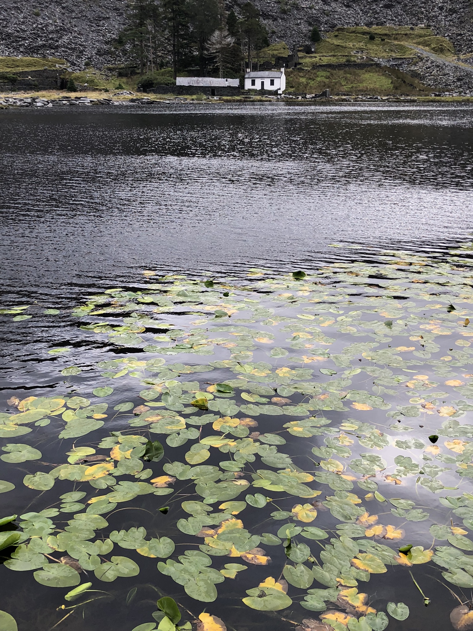
Now we’re on a long downward track off the mountain, towards a smaller quarry, Conglog, which has its own barrack block, and Llyn Cwmorthin, with its lily pads behind a row of crawiau. A lone white cottage sits on the far shore. Further still, there’s a skeletal ruined chapel and yet more barracks. We meet one or two people on the way, including a woman taking her dog for a high-level stroll. By the bottom, the stream to our right has become a rushing torrent. At last, we reach Tanygrisiau, amble along to the reservoir, and wait for our taxi at the Lakeside Café. The taxi driver doesn’t seem to know the quickest way back to Beddgelert, and takes us on a scenic and very roundabout route, via Blaenau Ffestiniog, Betws-y-coed and Capel Curig: a foretaste of Stage 2 of the Trail, to be tackled next spring.
Back in Beddgelert we mark the successful completion of Stage 1 with a more elaborate meal than normal, in the excellent Bistro Hebog, in the company of Range Rover types with posh English accents. In this cosy place it’s easy not to think of those slate miners 150 years ago, huddled in their draughty, comfortless barrack blocks on the cold mountainside.
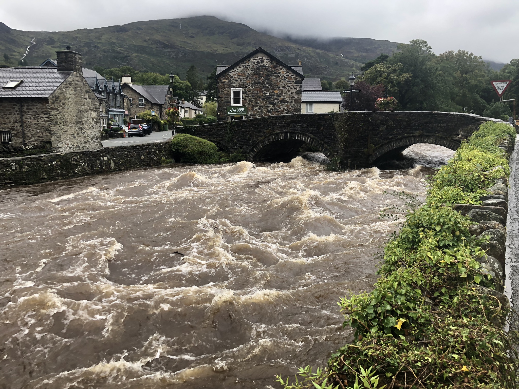
In the morning we leave the village by bus. The heavy rain is back. We say goodbye to C2, who’s going to Bangor. C1 and I take two Sherpa buses to reach Pen-y-Pass and then Llanberis and pick up the car. Swollen by the rains, Afon Glaslyn is brown, fast and angry. At Nantgwynant the mountains are streaked with broad silver torrents of water, Afon Nant Peris has burst its banks, and the road down Llanberis Pass is awash. It’s not safe to return this way by car, and we’re forced to head north towards Caernarfon before hitting the A487 and the long road home.
Leave a Reply