
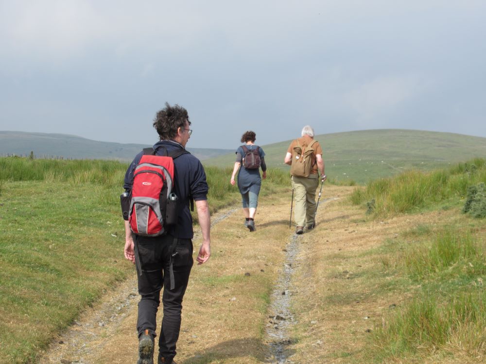
The three of us are delivered back by car from Pennant to Y Star in Dylife – coming this way you can appreciate the scale of the lead waste tips – and we wait for M-A and her family to arrive from Trefenter. Our host tells us that the worst part of this final day is the long drag up to rejoin the Way, and that the rest is easy going. This turns out to be more than a mild exaggeration. Once we’re all assembled – we’re now a party of eight – we trudge up the hill to the ridge that carries the Way, and carry on westwards. Again we’re walking on bare rock. At Penycrocbren, a sinister placename, we miss seeing what the Ordnance Survey calls a ‘Roman fortlet’. M-A comments that this may be too cuddly a term to describe the lethal force of the imperial Roman legions.
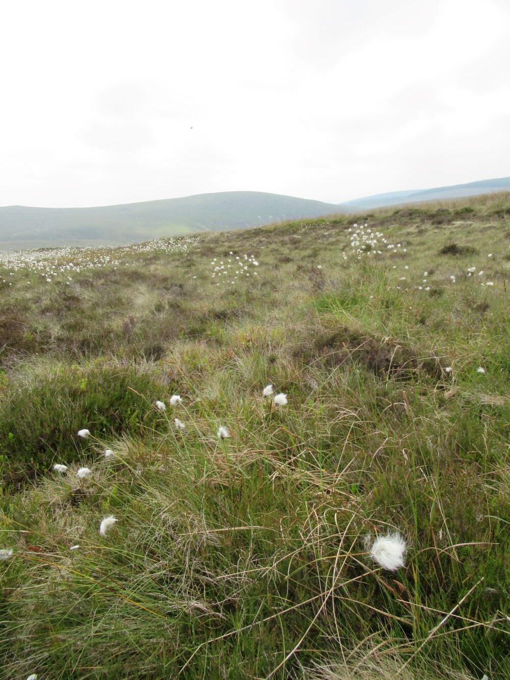
It’s already warm, and as the day wears on it seems more and more likely that we’ll be overtaken by the long-promised thunderstorm. As it turns out, although the skies turn very dark behind us, and a few drops of rain fall, we’re spared. On this upland section flora are limited to heather, cottongrass and other short, hardy plants, but larks are singing again on every side, and from a wood to our left comes the clear sound of a cuckoo. We’re already strung out, as happens with larger walking groups, and the two lads are far ahead.
Suddenly the even path gives way to a miniature Alpine valley, full of trees, with a stream running through it. On the other side is another old lead mine, and above it a dam, now broken, used to control the flow of water to the workings. There’s only one small stone building to be seen, possibly the base of the mine’s Captain. No doubt the workers either lived in shacks or tents, or more likely faced a long walk each day up from Dylife. It must have been a harsh living. A little further on, with a good view of the valley and the moorland, is a stone memorial, laid flat on the ground, with this inscription:
Er cof am
MAURICE JONES GRIFFITHS
Nantyfyda, Cefngwyrgrug a Llwyn Celyn
1913 – 1998
Amaethwr a Bugail
a dreuliodd ei oriau hapusaf yn y lle hwn
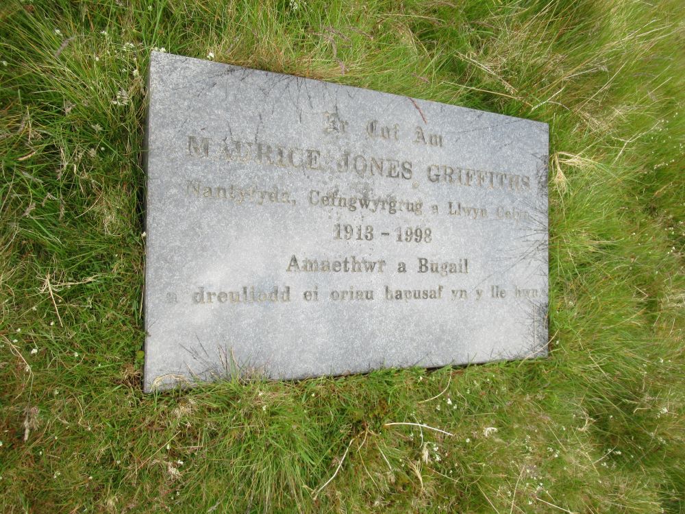
About Mr Griffiths the internet has little to say, except that he was awarded an MBE in 1980 ‘for services to agriculture in Wales’ (his shepherding goes unmentioned). But many people must still remember him, and it’s good to imagine him standing here in the sun, surveying his workplace of many decades, the rolling hills and moors.
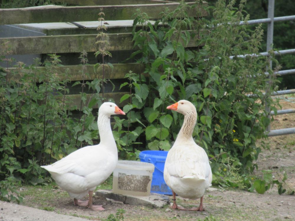
At Glaslyn we meet three people who’ve just come from swimming in its waters, and recommend its properties. Alas, we have no time, and many miles to go. At this point D. and the two boys leave us, to return to their car and scout the eating places of Machynlleth for us. The five of us left make for the flanks of Foel Fadian. This is the highest point reached by Glyndŵr’s Way. No one seems keen on the guidebook’s suggested diversion to the summit. Having climbed, with a sheer rocky ravine to our left, we now have a long downhill stretch to the valley below at Nantyfyda, where two geese stand like statues as we pass. We turn off the lane before the hamlet of Aberhosan – Glyndŵr’s Way takes perverse pleasure in avoiding anything remotely urban – and instead we pass through a wood. There are no other walkers, but this leg of the Way does attract cyclists. They tend to sneak up on us unawares, and once one of them arrived just in time for us to hold the gate open for him (this must have been an unproblematic gate).
More steep hills await, and having passed Cleiriau Isaf we throw ourselves down in a field and have lunch. In the heat the sandwiches have melted into a sticky, unappetising mass. At the next farm, Talbontdrain, we see unusual signs welcoming walkers (normally we don’t have the impression that farmers see such people as anything other than a nuisance). A young man and a three-legged dog come out to welcome us. The dog says nothing, though she’s friendly enough, but the man tells us he came from Essex to stay here for a while, and so fell in love with the area that he decided to stay and rent nearby. M-A has the presence of mind to ask for water – all of us are now running short – and he’s happy to fill all our bottles.

After this the going is harder still. The horseflies are now out in force and in the mood to bite, sometimes causing blood to flow – though I suppose we should be grateful that they and other insects still thrive in these parts. The heat has increased, and I use my hat more often as a sweat sponge than as sun protection. And the steep hills continue. We see new signs saying ‘Mach 1’, ‘Mach 2’ and ‘Mach 3’, which at first we thought were recommended walking speeds, but turn out to be cycling routes to Machynlleth.
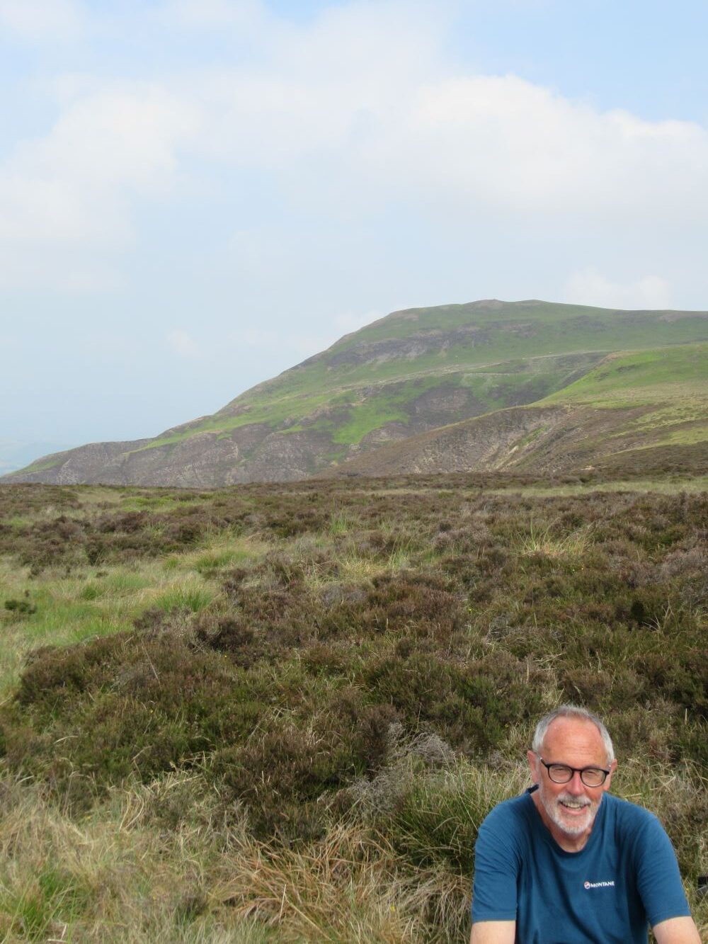
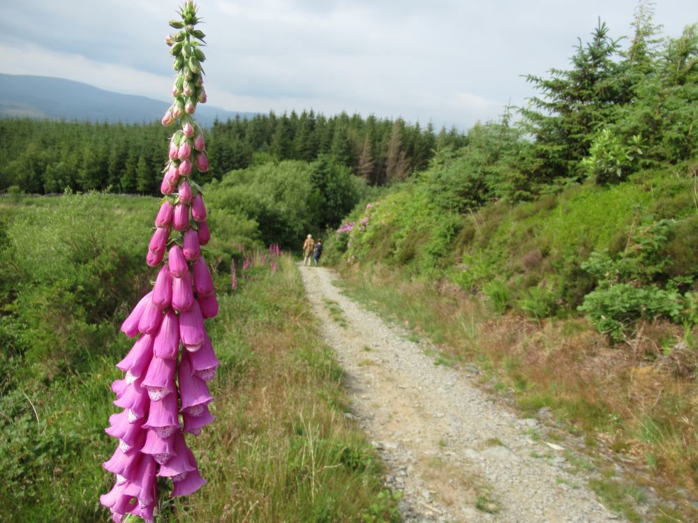
Then we find ourselves on a long track that follows contours rather than defying them. We take a rest, and a farmer on a quad bike stops to talk; he’s the first farmer we’ve met who isn’t Powys born-and-bred. Despite the heat, visibility is good: to the north we can make out the distant silhouette of Cadair Idris, with its long ridge and three peaks. Walking through a wood we pass banks of foxgloves, newly in flower, and rhododendrons, escaped from some garden and spreading fast. Another short wood is darker and spookier: M-A wonders if we’ll be ambushed by goblins.
Ever since leaving Knighton we’ve been expecting to meet Owain Glyndŵr, somewhere along his Way. As we approach Machynlleth on a high ridge it’s possible that this is the moment. Behind us the sky has darkened, as if a storm is brewing. Ahead, a strange long white cloud has grown against the hills on the other side of the Dyfi. And above us a skylark suddenly erupts into sound. Could this be the voice of Owain speaking to us? It’s hard to be sure.
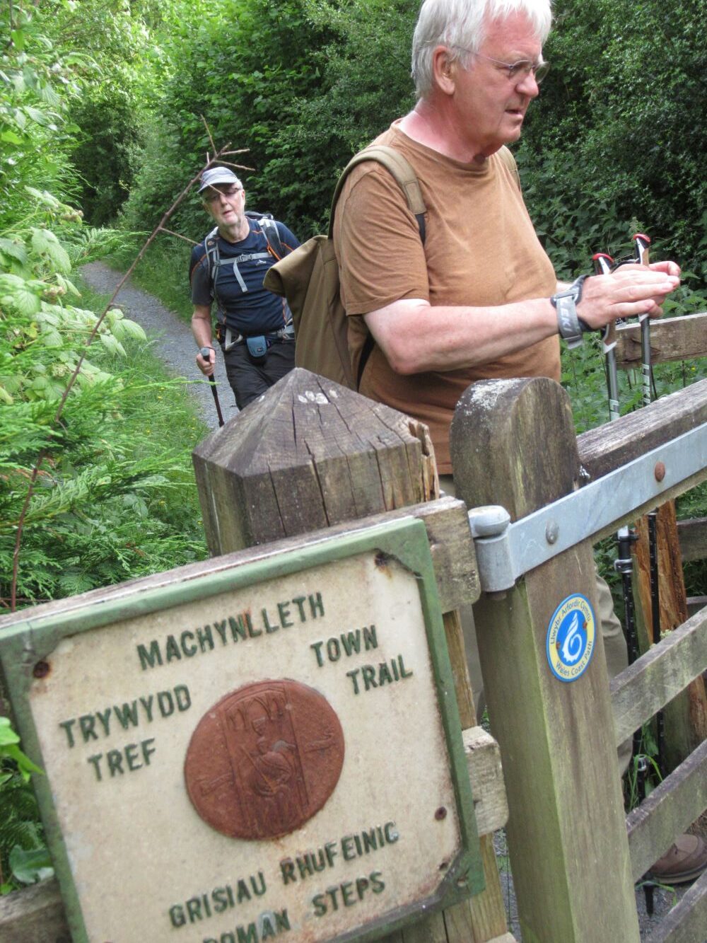
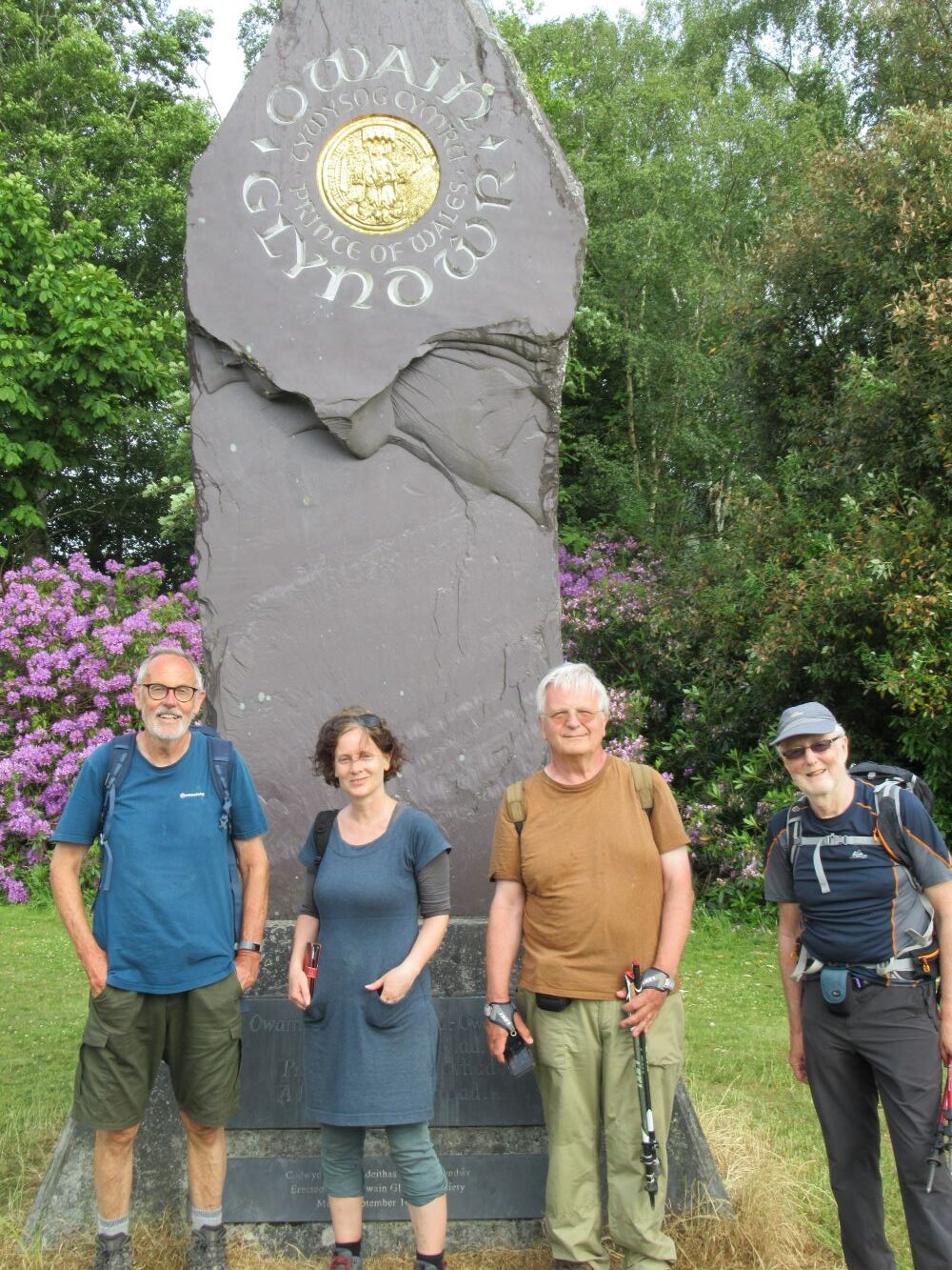
The path takes us on a semi-circular, high-level tour round Machynlleth before allowing us to enter the town, and it’s six o’clock before we’re ushered down the so-called Roman Steps (shared with the Wales Coast Path, so familiar to us) and the end of the walk. The final stretch takes us through the grounds of Plas Machynlleth, and there to greet us is the Owain Glyndŵr monument. It’s made from a massive block of slate from Penrhyn Quarry (that’s another story), inscribed by Ieuan Rees and unveiled in 2000, six hundred years after Owain declared himself prince of Wales. An englyn on it, written by Dafydd Wyn Jones, invokes him as a ‘waker’ of Wales:
Owain, tydi yw’n dyhead, – Owain,
Ti piau’n harddeliad,
Piau’r her yn ein parhad
A ffrewyll ein deffroad.
We reunite with D. and the lads and make straight for the bar of the Wynnstay Hotel and several pints of Twrch ale. Later four of us return to the Wynnstay for a good meal, to celebrate finishing our seventy-five miles and hundreds of metres of ascent and descent.
We decide to meet again sometime to walk the second part of the Way, from Machynlleth to Welshpool. But next time, we agree, we’ll reduce the average daily mileage. We are, after all, getting on in years as well as miles.
Leave a Reply